Lovelady, Texas facts for kids
Quick facts for kids
Lovelady, Texas
|
|
|---|---|

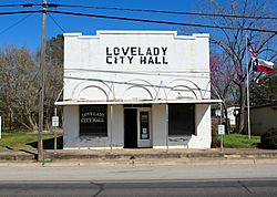
Lovelady City Hall
|
|

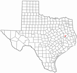
Location of Lovelady, Texas
|
|
 |
|
| Country | United States |
| State | Texas |
| County | Houston |
| Area | |
| • Total | 1.33 sq mi (3.44 km2) |
| • Land | 1.32 sq mi (3.42 km2) |
| • Water | 0.01 sq mi (0.02 km2) |
| Elevation | 299 ft (91 m) |
| Population
(2020)
|
|
| • Total | 570 |
| • Density | 474.64/sq mi (183.27/km2) |
| Time zone | UTC-6 (Central (CST)) |
| • Summer (DST) | UTC-5 (CDT) |
| ZIP code |
75851
|
| Area code(s) | 936 |
| FIPS code | 48-44260 |
| GNIS feature ID | 2410885 |
Lovelady is a small town in Houston County, Texas, United States. In 2020, about 570 people lived there. It's a quiet place with a rich history and a strong community feel.
Contents
History of Lovelady
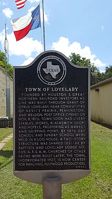
Lovelady was started by people who invested in the Houston & Great Northern Railroad. This happened when a railway line was built through land that belonged to Cyrus Lovelady. The town grew near other communities like Nevil's Prairie, Pennington, and Weldon.
The first U.S. Post Office in Lovelady opened on November 8, 1872. Soon, the town had places like stables for horses (called livery), a blacksmith shop for metalwork, and hotels. It became a busy place for buying and selling goods, and for shipping things by train. By 1876, a public school was held in a local log house. Lovelady officially became an incorporated town in 1927.
Geography and Location
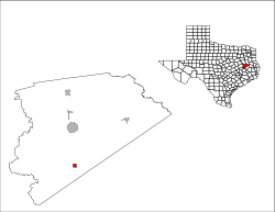
Lovelady is found in the southern part of Houston County, Texas. Texas State Highway 19 runs right through the middle of town. This highway is known as Commerce Street in Lovelady.
If you travel north on Highway 19, you'll reach Crockett, which is the main city of the county, about 14 miles away. If you go south the same distance, you'll get to Trinity.
The town covers a total area of about 1.33 square miles (3.4 square kilometers). Most of this area is land, with only a tiny bit of water. The water areas are mostly small streams that flow into White Rock Creek, which is part of the larger Trinity River system.
Climate in Lovelady
The weather in Lovelady is known for its hot and humid summers. Winters are generally mild to cool. This type of weather is called a humid subtropical climate. On climate maps, you might see it labeled as "Cfa."
Population and People
| Historical population | |||
|---|---|---|---|
| Census | Pop. | %± | |
| 1920 | 625 | — | |
| 1930 | 502 | −19.7% | |
| 1940 | 542 | 8.0% | |
| 1950 | 541 | −0.2% | |
| 1960 | 466 | −13.9% | |
| 1970 | 388 | −16.7% | |
| 1980 | 509 | 31.2% | |
| 1990 | 587 | 15.3% | |
| 2000 | 608 | 3.6% | |
| 2010 | 649 | 6.7% | |
| 2020 | 570 | −12.2% | |
| U.S. Decennial Census | |||
The population of Lovelady changes over time. According to the 2020 United States census, there were 570 people living in the city. These people lived in 349 households, and 154 of these were families.
The town is home to people from different backgrounds. Here's a look at the racial makeup of Lovelady in 2020:
| Race | Number | Percentage |
|---|---|---|
| White (NH) | 392 | 68.77% |
| Black or African American (NH) | 68 | 11.93% |
| Native American or Alaska Native (NH) | 1 | 0.18% |
| Asian (NH) | 6 | 1.05% |
| Mixed/Multi-Racial (NH) | 25 | 4.39% |
| Hispanic or Latino | 78 | 13.68% |
| Total | 570 |
Notable Person
- Charles Harrelson, father of actor Woody Harrelson
Economy of Lovelady
A big part of Lovelady's economy comes from the Texas Department of Criminal Justice – Eastham Unit. This is a large facility that employs many people from the area. It has a staff of 718 employees, making it a major employer in the town.
Education in Lovelady
Students in Lovelady attend schools that are part of the Lovelady Independent School District. This district serves the educational needs of the city's children and teens.
Historic Architecture
One interesting building in Lovelady was completed in 1906 by Charles Rufus Rich (1857–1945). He designed it to be a general store on the ground floor and his home on the second floor. Rich, who was from Texas, started his business in Lovelady in the early 1900s.
See also
 In Spanish: Lovelady para niños
 | Charles R. Drew |
 | Benjamin Banneker |
 | Jane C. Wright |
 | Roger Arliner Young |


