Lower Sioux Indian Reservation facts for kids
Quick facts for kids
Lower Sioux Indian Community
|
||
|---|---|---|
|
||

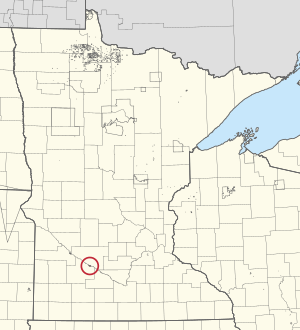
Location of the Lower Sioux Indian Community
|
||
| Established | 1851 | |
| Capital | Morton, Minnesota | |
| Area | ||
| • Total | 2.69 sq mi (7.0 km2) | |
| Population
(2020)
|
||
| • Total | 534 | |
| Demonym(s) | Mdewakanton | |
| Time zone | CT | |
| Area code(s) | 507 | |
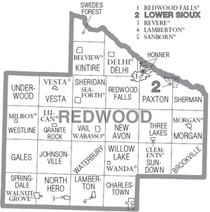
The Lower Sioux Indian Community is a special place for the Mdewakanton and Wahpekute bands of the Dakota people. It's an Indian reservation located in Redwood County, Minnesota, right along the southern bank of the Minnesota River. The main office for the community is near Morton, Minnesota.
This area was set aside for the Lower Sioux in 1851 by a special agreement called the Treaty of Traverse des Sioux. This treaty was made with the federal government of the United States. The original reservation was much larger, stretching about 70 miles (113 km) along the river. It was 20 miles (32 km) wide.
After the Dakota War of 1862, the size of the reservation was made much smaller. As of 2020, about 534 people live here. The land area is about 2.69 square miles (6.97 km²).
Contents
History of the Lower Sioux Community
The land around the Lower Sioux Indian Community is mostly countryside. It is used for farming crops like corn and soybeans. Over time, changes to the land for farming have also affected the local plants and animals.
Efforts to End Tribal Status
From the 1940s to the 1960s, the United States government had a policy called "termination." This policy aimed to end the special relationship between Native American tribes and the federal government. The idea was to have tribes become more like other citizens. Their shared tribal land would be divided among individual families.
In the 1950s, four Native American tribes in Minnesota were considered for this policy. The Lower Sioux Community was one of them. Discussions about this began in 1953.
However, the Dakota people and even local residents did not agree with this plan. They worried that counties and states would have to pay more for services if the tribes lost their special status. The Minnesota Governor's Commission on Human Rights also spoke against it. Because of this strong opposition, the bill to end the tribes' status did not pass.
Returning Land to the Lower Sioux
In 2021, a very important event happened. The Minnesota state government and the Minnesota Historical Society returned some land to the Lower Sioux Community. This land was part of their historic homeland. It had been taken by the federal government after the Dakota War of 1862.
On February 12, 2021, about 115 acres (47 hectares) of land were given back to the reservation. This land is near the historic site of the Lower Sioux Agency.
Lower Sioux President Robert Larsen spoke about this return. He said, "I don't know if it's ever happened before, where a state gave land back to a tribe." He also added that their ancestors "paid for this land over and over with their blood, with their lives." This return was not a sale; it was a recognition of their history.
Tribal Businesses
The Mdewakanton tribe runs several businesses. These businesses help the community and provide jobs.
Jackpot Junction Casino Hotel
One of the main businesses is the Jackpot Junction Casino Hotel. It started in 1984 as a bingo hall. Today, it is a large casino and hotel. It provides many jobs for people in the surrounding areas.
Jackpot Junction Casino Hotel was the first casino in Minnesota. Besides gaming areas, it has three bars and three restaurants. There's also an amphitheater for live shows and two large ballrooms. Live music, often country or rock, is played every weekend. The casino is open all day, every day.
Lower Sioux Agency Historic Site
The Lower Sioux Agency is a historic site on the reservation. It is connected to the Dakota War of 1862. The Lower Sioux Community helps manage this site. They work together with the Minnesota Historical Society.
County Highway 2 goes through the reservation. This road connects it to U.S. Route 71 and Minnesota State Highway 19.
Geography
The Lower Sioux Indian Community covers a total area of about 2.74 square miles (7.10 km²). Most of this is land, about 2.69 square miles (6.97 km²). A small part, about 0.05 square miles (0.13 km²), is water.
Population and People
In 2020, the population of the Lower Sioux Indian Reservation was 534 people. The community is home to about 198.7 people per square mile (76.7 per km²).
Most of the people living on the reservation are Native American (79.6%). There are also people who identify as White (9.6%) and other races. About 10.1% of the population identifies as Hispanic or Latino.
 | Audre Lorde |
 | John Berry Meachum |
 | Ferdinand Lee Barnett |


