Lucifer Peak facts for kids
Quick facts for kids Lucifer Peak |
|
|---|---|

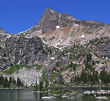
Lucifer Peak, south aspect
|
|
| Highest point | |
| Elevation | 2,726 m (8,944 ft) |
| Prominence | 116 m (381 ft) |
| Parent peak | Devils Dome (2769 m) |
| Geography | |
| Location | Valhalla Provincial Park British Columbia, Canada |
| Parent range | Valhalla Ranges Selkirk Mountains |
| Topo map | NTS 82F/13 |
| Climbing | |
| First ascent | 1970 by Bob Dean, Howie Ridge |
Lucifer Peak is a tall mountain in British Columbia, Canada. It stands about 2,726 meters (8,944 feet) high. This peak is part of the Valhalla Ranges, which are found within the larger Selkirk Mountains.
You can find Lucifer Peak inside Valhalla Provincial Park. It's located about 8.8 kilometers (5.5 miles) west-northwest of Gladsheim Peak. It's also about 18 kilometers (11 miles) west of Slocan Lake. The name "Lucifer Peak" became official on July 26, 1977.
About the Devils Range
Lucifer Peak is part of a smaller group of mountains called the Devils Range. This range is a subrange of the Valhalla Mountains. What's interesting is that many peaks in this area have names related to devils or demons.
Some of these peaks include Black Prince Mountain, Mount Mephistopheles, Devils Dome, Mount Diablo, Satan Peak, Devils Spire, and Devils Couch. These names give the area a unique and somewhat spooky theme!
Climate and Water
Lucifer Peak has a very cold climate, known as a subarctic climate. This means it has long, snowy winters and mild summers. Winter temperatures can drop really low, sometimes feeling like -30°C (-22°F) or even colder with the wind chill.
When snow melts and rain falls on the mountain, the water flows into Gwillim Creek and Evans Creek. These creeks then join the Slocan River.
Climbing the Peak
The first people to successfully climb to the very top of Lucifer Peak were Bob Dean and Howie Ridge. They reached the summit on August 24, 1970. They used a path along the mountain's east ridge.
Over the years, other climbing paths have been discovered and used:
- East Ridge - This was the first route, climbed in 1970.
- Northwest Ridge - This route was first climbed in 1980.
- Southwest Face - This path was first climbed in 1983.
 | Leon Lynch |
 | Milton P. Webster |
 | Ferdinand Smith |


