Lurg Mhòr facts for kids
Quick facts for kids Lurg Mhòr |
|
|---|---|
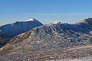
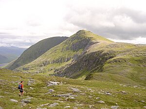
East ridge leading to the summit of Lurg Mhòr (left of centre)
|
|
| Highest point | |
| Elevation | 986 m (3,235 ft) |
| Prominence | 442 m (1,450 ft) |
| Listing | Munro, Marilyn |
| Naming | |
| English translation | big ridge stretching into the plain / big shin |
| Language of name | Gaelic |
| Geography | |
| Parent range | Northwest Highlands |
| OS grid | NH064404 |
| Topo map | OS Landranger 25 Explorer 429 / 430 |
Lurg Mhòr is a tall mountain in the Northwest Highlands of Scotland. It stands at 986 meters (about 3,235 feet) high. This mountain is known as a Munro, which is a Scottish mountain over 3,000 feet (914.4 meters) tall. Lurg Mhòr is part of a range of hills that also includes Meall Mor and Bidein a' Choire Sheasgaich. It's a very remote and wild place.
Contents
Where is Lurg Mhòr Located?
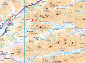
Lurg Mhòr is found west of Loch Monar and east of the Attadale Forest. It is one of several Munros that form a horseshoe shape around the loch. To the north is Glen Carron, and to the south is Glen Shiel.
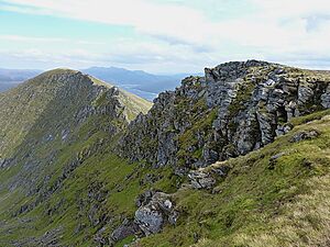
The mountain has a long ridge that stretches to the east. On this ridge, you'll find Meall Mhor, which is another high point. This ridge can be narrow in some spots. You might need to do some scrambling, which means using your hands to climb over rocks. The northern side of this ridge has steep cliffs. However, the southern side is gentle and covered in grass. This ridge eventually leads down to Loch Monar.
Getting to the Mountain
Lurg Mhòr and Bidein a' Choire Sheasgaich are considered two of Scotland's most isolated Munros. This means they are far from roads and towns. Getting to them is a long and tough journey. You can approach the mountain from the north, east, or west.
Many people choose to make this a two-day trip. There are three open bothies (simple shelters) available for hikers to stay in overnight. This is a great alternative to camping outdoors.
Routes from the East
One way to reach Lurg Mhòr is from the east, by following the path along Loch Monar. You can get to the loch through Glen Strathfarrar. From a place called Struy, there's a private road that goes to Monar Lodge at the start of the loch. You can cycle on this road, and a very small number of cars are allowed. Even with a mountain bike, this trip is a big adventure. It can be a very challenging one-day hike or a more relaxed overnight trip. A long route around the loch, including these Munros, can take about 18 hours, plus 52 km of cycling.
Routes from the North
The shortest way to the mountain from a public road is from Achnashellach in Glen Carron. To start, you might need to wade across the River Carron or use a special two-wire bridge. Cycling is not an option on this specific path.
Another route starts from Craig, which is nearby. This path is a bit longer, but you can cycle the first 5.5 km. From there, it's about 14.5 km on foot to Lurg Mhòr, taking around 5 hours and 30 minutes.
Bothies for Overnight Stays
Bearnais bothy is a shelter maintained by the Mountain Bothies Association. It's a good place to stop if you're hiking in the area. You can reach it from Achintee, near Strathcarron station, by following a 6-mile (about 9.7 km) path.
From the west, starting at Attadale, there's an 8-mile (about 12.9 km) track. You can ride a mountain bike on this track, though it can be difficult. This track leads to Ben Dronaig Lodge, which is another open bothy. The Attadale Estate keeps this bothy in very good condition. From Ben Dronaig Lodge, it's another 4.5 miles (about 7.2 km) to Lurg Mhòr on a mountain path. A shorter 6-mile (about 9.7 km) path also leads to this bothy from Achintee.
Maol Bhuidhe bothy is another MBA bothy. You can reach it from Attadale or Killian (Camus-luinie carpark). These routes involve tracks that are at least 10 miles (about 16 km) long, suitable for mountain biking.
 | Percy Lavon Julian |
 | Katherine Johnson |
 | George Washington Carver |
 | Annie Easley |


