Mörbylånga Municipality facts for kids
Quick facts for kids
Mörbylånga Municipality
Mörbylånga kommun
|
||
|---|---|---|
 |
||
|
||
 |
||
| Country | Sweden | |
| County | Kalmar County | |
| Seat | Mörbylånga | |
| Area | ||
| • Total | 3,061.46 km2 (1,182.04 sq mi) | |
| • Land | 669.9 km2 (258.6 sq mi) | |
| • Water | 2,391.56 km2 (923.39 sq mi) | |
| Area as of January 1, 2010. | ||
| Population
(June 30, 2012)
|
||
| • Total | 13,851 | |
| • Density | 4.52431/km2 (11.7179/sq mi) | |
| Time zone | UTC+1 (CET) | |
| • Summer (DST) | UTC+2 (CEST) | |
| ISO 3166 code | SE | |
| Province | Öland | |
| Municipal code | 0840 | |
| Website | www.morbylanga.se | |
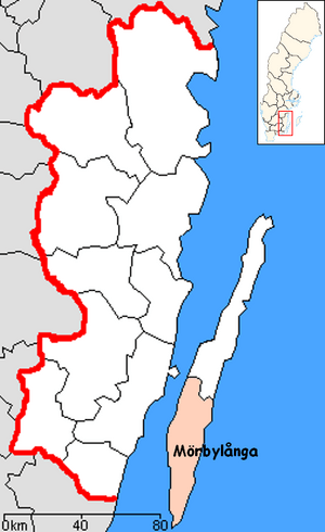
Mörbylånga Municipality (which is called Mörbylånga kommun in Swedish) is a special area in Sweden. It is like a local government district. This municipality is found in Kalmar County, in the southeastern part of Sweden.
It is located on the beautiful island of Öland, which is in the Baltic Sea. The main town where the local government meets is called Mörbylånga. However, the biggest town in the municipality is Färjestaden.
Contents
How Mörbylånga Municipality Was Formed
The Mörbylånga Municipality we know today was created in 1974. Before that, the area was made up of many smaller parts.
In 1952, these smaller parts were grouped into three larger areas. Later, in 1967, the area called Ottenby joined Mörbylånga. Then, in 1974, Torslunda was added, making the municipality its current size. It now covers the whole southern part of the island of Öland.
Ancient History and Nature in Mörbylånga
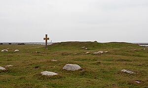
Mörbylånga Municipality is full of old history, just like the northern part of Öland. You can find many ancient remains here.
Old Forts and Castles
There are about 20 old hillforts on the island of Öland. These were strongholds built a very long time ago. The most famous one in southern Öland is the fortress called Eketorp. It's a great place to learn about the past!
Amazing Wildlife and Birdwatching
The southern parts of Öland are also home to special wildlife areas. Many migratory birds stop here on their long journeys north or south.
A very popular spot for birdwatchers is the southernmost point of the island. Here, you'll find a tall lighthouse called Långe Jan, which means "Tall John." Many different birds gather here before they fly across the sea. It's a fantastic place to see many kinds of birds!
Towns and Villages in Mörbylånga
Mörbylånga Municipality has 9 main towns and villages. These are also known as "urban areas" or Tätort in Swedish.
The table below lists these places. They are ordered by how many people lived there on December 31, 2005. The main town of the municipality, where the local government is, is shown in bold.
| # | Locality | Population |
|---|---|---|
| 1 | Färjestaden | 4,636 |
| 2 | Mörbylånga | 1,784 |
| 3 | Skogsby | 528 |
| 4 | Algutsrum | 499 |
| 5 | Degerhamn | 372 |
| 6 | Vickleby | 310 |
| 7 | Gårdby | 262 |
| 8 | Arontorp | 231 |
| 9 | Kastlösa | 208 |
People and Population in Mörbylånga
In 2022, there were about 15,717 people living in Mörbylånga Municipality. About 12,229 of these people were Swedish citizens old enough to vote.
This area is a mix of people from different backgrounds. Most people living here were born in Sweden. However, there are also many people who were born in other countries or have parents from other countries. This makes Mörbylånga a diverse and interesting place!
Images for kids
See also
 In Spanish: Municipio de Mörbylånga para niños
 | Toni Morrison |
 | Barack Obama |
 | Martin Luther King Jr. |
 | Ralph Bunche |


