
M18 motorway (Great Britain) facts for kids
Quick facts for kids
|
||||
|---|---|---|---|---|
_map.svg) |
||||
| Route information | ||||
| Part of |
||||
| Length | 26.5 mi (42.6 km) | |||
| Existed | 1967–present | |||
| History | Constructed 1967–79 | |||
| Major junctions | ||||
| From | Thurcroft 53°22′52″N 1°16′43″W / 53.3811°N 1.2785°W |
|||
M1 motorway A1(M) motorway M180 motorway M62 motorway |
||||
| To | Rawcliffe 53°40′57″N 0°58′03″W / 53.6825°N 0.9676°W |
|||
| Location | ||||
| Primary destinations: |
Sheffield, Rotherham, Doncaster, Leeds | |||
| Road network | ||||
|
||||

The M18 is a major motorway in Yorkshire, England. It helps drivers travel across the region. This road starts near Rotherham from the M1 motorway. It then goes past the city of Doncaster. Finally, it reaches the M62 motorway near Goole.
The M18 is important because it links the M1 to the area around the River Humber. This includes cities like Hull. The motorway is about 26 miles (42 kilometers) long.
Contents
What is the M18 Motorway?
The M18 is a special type of road called a motorway. Motorways are designed for fast and safe travel. They have multiple lanes and no traffic lights. This allows cars to keep moving smoothly.
Why Was the M18 Built?
The M18 was built to improve travel in Yorkshire. It helps connect important cities and other motorways. Construction of the M18 started in 1967. The entire road was finished by 1979. It has been a key route for many years.
Where Does the M18 Go?
The M18 runs from south to north through Yorkshire. It connects several major towns and cities.
- Southern End: The M18 begins at Thurcroft, close to Rotherham. Here, it connects directly to the M1 motorway. The M1 is a very long road that goes all the way to London.
- Northern End: The M18 ends at Rawcliffe. This is where it meets the M62 motorway. The M62 is another important road that crosses England from east to west.
Cities and Towns Along the Way
As you travel along the M18, you pass by several places:
- Rotherham: A large industrial town.
- Doncaster: A historic market town. It also has an airport nearby.
- Goole: A port town near the end of the motorway.
Connecting Major Roads
The M18 is like a bridge between other important motorways. It helps traffic flow easily across the region.
- M1 Motorway: At its southern end, the M18 joins the M1. This link is vital for journeys to Sheffield, Leeds, and further south towards London.
- A1(M) Motorway: The M18 also connects to the A1(M) motorway. This road is a major route for travel north and south in England.
- M180 Motorway: Near Doncaster, the M18 connects to the M180 motorway. This road leads towards Scunthorpe and Grimsby. It also provides access to Humberside Airport.
- M62 Motorway: At its northern end, the M18 links up with the M62. This connection is important for people traveling to Hull, York, and Leeds.
Images for kids
-
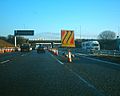
M18 northbound during the 2005–2006 roadworks
-
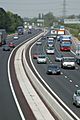
M18 in South Yorkshire


