Macal River facts for kids
Quick facts for kids Macal |
|
|---|---|

Macal River in Belize
|
|
| Country | Belize |
| Physical characteristics | |
| Main source | Maya Mountains 953 m (3,127 ft) (Cooma Cairn) |
| River mouth | Belize River |
| Length | 320 km (200 mi) |
| Basin features | |
| Basin size | 1,492 km2 (576 sq mi) |
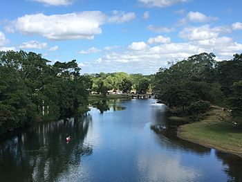
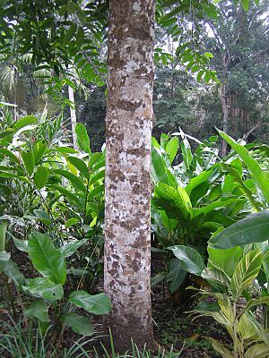
The Macal River is an important river in western Belize. It flows through the Cayo District. Along its banks, you can find interesting places like the ancient Maya city of Cahal Pech. The beautiful Belize Botanic Gardens are also nearby.
The Macal River starts in the rugged Maya Mountains. It flows north and joins with the Mopan River. Together, they form the larger Belize River. Many smaller streams flow into the Macal River. These include Privassion, Rio On, Rio Frio, Mollejon, and Cacao Camp. The area of land that drains into the Macal River is about 1492 square kilometers.
The land around the river's source is very steep. There is also a lot of rain in the upper parts of the Macal River basin. This means the river can rise very quickly. This fast rise often causes flooding downstream in the Belize River. Some say the river is named after a beautiful young girl named Macall. People use canoes to travel on the lower part of the river all year round.
Contents
How the Macal River Flows
The Macal River's water system is split into two main parts. The upper part, where the river begins, is about 1000 square kilometers. It is located in the southern Maya Mountains. The lower part is known as the Mountain Pine Ridge area.
The soil in the upper part of the river basin is thin and rocky. This causes rainwater to run off quickly into the river. All the small streams in the upper area join the main Macal River before a place called Guacamayo. The river's water levels are highest during the rainy season, from June to August. There are still some rains until February. The lowest water levels are during the dry season, from March to May.
In the lower Macal River area, many streams flow into the main river. These include the Privassion, Rio On, Rio Frio, Mollejon, Chaa Creek, and Cacao Camp. In this lower area, the dense forest floor slows down the water runoff. This means the fast water from the upper river can catch up with the slower water from the lower area. When they meet, they create a very large wave of water. This makes flooding worse in the Belize River.
Animals and Plants of the Macal River
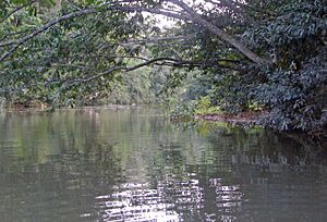
The Macal River flows through large areas of tropical forest. These forests include parts of the Chiquibul Forest Reserve and National Park. The river's area has many different kinds of plants and animals. You can find large animals, birds, fish, reptiles, amphibians, and smaller mammals.
The Macal River area is home to many rare and endangered species. Two very important animals found here are the jaguar and Baird's tapir. The jaguar is a large wild cat. The Baird's tapir is Belize's largest land animal and is also the national animal of Belize.
There are many birds in the Macal River basin. In the Mountain Pine Ridge area alone, you can see birds like the rufous-capped warbler and the eastern bluebird. Between autumn and spring, you might also spot the hepatic tanager. Raptors, like the orange-breasted falcon, hunt in the valleys. This area is one of the best places in Belize to see the orange-breasted falcon.
The Chalillo Dam
A large dam called the Chalillo Hydroelectric Dam was built on the Macal River. It was finished in 2005. The dam is about 33 km (21 mi) south of San Ignacio, Belize. It was built by Fortis Inc., a company from Canada. Building the dam caused some debate because of its possible effects on the surrounding rainforest.
Ancient History of the Macal River Area
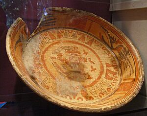
Long ago, the lower parts of the Macal River area were home to the ancient Maya. Several Maya towns were located here. These include the Cahal Pech site and another unexcavated site at Chaa Creek. These towns were centers for larger farming communities. They might have been connected to bigger Maya cities like Tikal or Caracol.
The Maya society in this area declined in the ninth century AD. This was likely due to running out of farming resources. The land might not have been able to support so many people. Social problems could have also made things worse.
Fun Activities and Ecotourism
The highest parts of the Macal River area are hard to reach. Only very strong hikers can get there. However, the Mountain Pine Ridge area is easy to visit by car. Most fun activities in this area are within the Mountain Pine Ridge Forest Reserve. This is a national park in Belize.
You can find hiking trails that lead into the wilderness. This area also has Belize's largest limestone caves. You can explore these caves by floating on tubes in the clear water. Sometimes, sunlight shines through holes in the cave roof, lighting up the water. The Rio Frio area has the biggest of these water-filled caves.
In the lower part of the river, there are several jungle resorts. These resorts offer access to the Macal River for floating or canoe trips to San Ignacio. Except for the times when the river is very high (June to October), you can canoe upstream against the current. There are some small rapids, but canoeing here is not too difficult. You can also visit a replica Maya farm, a morpho butterfly preserve, and a small Maya museum in the lower river area.
See also
 In Spanish: Río Macal para niños
 | John T. Biggers |
 | Thomas Blackshear |
 | Mark Bradford |
 | Beverly Buchanan |


