Machuelo Abajo facts for kids
Quick facts for kids
Machuelo Abajo
|
|
|---|---|

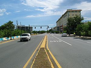
Street scene in southern Barrio Machuelo Abajo, in the city of Ponce
|
|

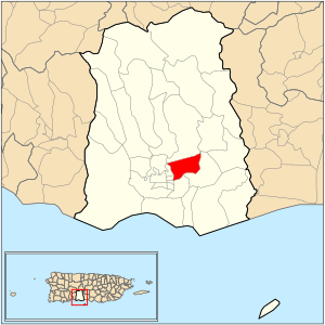
Location of barrio Machuelo Abajo within the municipality of Ponce shown in red
|
|
| Commonwealth | |
| Municipality | |
| Area | |
| • Total | 1.86 sq mi (4.8 km2) |
| • Land | 1.79 sq mi (4.6 km2) |
| • Water | 0.07 sq mi (0.2 km2) |
| Elevation | 85 ft (26 m) |
| Population
(2010)
|
|
| • Total | 11,855 |
| • Density | 6,622.9/sq mi (2,557.1/km2) |
| Source: 2010 Census | |
| Time zone | UTC−4 (AST) |
Machuelo Abajo is a special area, or barrio, in the city of Ponce, Puerto Rico. It is one of 31 barrios that make up the municipality of Ponce. Machuelo Abajo was once a rural area, meaning it was mostly countryside. Now, it is part of the city's urban zone. This barrio was first established in the year 1818.
Contents
Where is Machuelo Abajo Located?
Machuelo Abajo is an urban barrio. This means it is a developed part of the city. You can find it in the southern part of the municipality of Ponce. It is also in the northeast section of the city itself. Its exact location is at 18.024217 degrees North and -66.600217 degrees West.
What are Machuelo Abajo's Borders?
Machuelo Abajo has clear boundaries that separate it from other areas.
- To the North, it is bordered by Tito Castro Avenue, also known as PR-14.
- To the South, you will find Miguel Pou Boulevard and Abaisin Street.
- The Rio Portugues forms its western border.
- To the East, it is next to Los Negrones Hill, the Rio Bucana, and Emilio Fagot Street.
When looking at its neighbors, Machuelo Abajo shares borders with other barrios:
- Machuelo Arriba is to its North.
- San Anton and Sabanetas are to its South.
- Quinto and Sexto are to its West.
- Sabanetas is also to its East.
Communities and People in Machuelo Abajo

Machuelo Abajo is home to several communities. These are smaller neighborhoods where people live. Some of these communities include:
- Jardines Fagot
- La Rambla
- La Alhambra
- Extension La Alhambra
- Flamboyanes
- Bella Vista
- Santa Clara
- Riberas del Bucana
Other communities found here are Residencial Dr. Pila, Villa Esperanza, and Valle Verde.
This barrio covers about 1.77 square miles of land. It also has about 0.09 square miles of water. In the year 2000, about 13,302 people lived in Machuelo Abajo. This meant there were about 7,522 people living in each square mile. By 2010, the population was 11,855 people. The density was about 6,622.9 people per square mile.
The highest point in Machuelo Abajo is a place called Cerro Los Negrones. It stands 397 feet tall. This hill is located northwest of the Mercedita Airport.
Important Places in Machuelo Abajo
The Río Bucaná is a river that flows through Machuelo Abajo. Part of this river has been channelized, meaning its path has been changed for better flow. The new Hospital San Lucas is also located in Machuelo Abajo. This hospital is built where the old Ponce District Hospital used to be, on Puerto Rico Highway 14.
Famous People from Machuelo Abajo
Some well-known people have come from Machuelo Abajo. They include:
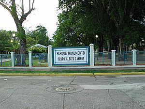
- Pedro Albizu Campos
- Marta Romero
- Héctor Lavoe
See also
 In Spanish: Machuelo Abajo (Ponce) para niños
- List of communities in Puerto Rico
 | Selma Burke |
 | Pauline Powell Burns |
 | Frederick J. Brown |
 | Robert Blackburn |


