Sexto, Ponce, Puerto Rico facts for kids
Quick facts for kids
Sexto
Cantera
|
|
|---|---|

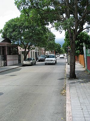
Daily life captured at Calle Mayor Cantera street in Barrio Sexto, in the Ponce Historic Zone, Ponce, Puerto Rico
|
|

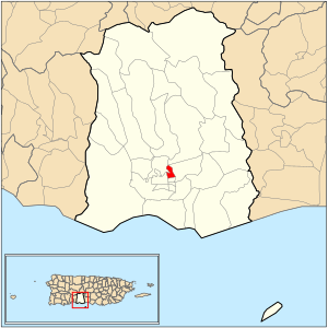
Location of barrio Sexto within the municipality of Ponce shown in red
|
|
| Commonwealth | |
| Municipality | |
| Area | |
| • Total | 0.27 sq mi (0.7 km2) |
| • Land | 0.27 sq mi (0.7 km2) |
| • Water | 0 sq mi (0 km2) |
| Elevation | 75 ft (23 m) |
| Population | |
| • Total | 3,529 |
| • Density | 13,573.1/sq mi (5,240.6/km2) |
| Source: 2010 Census | |
| Time zone | UTC−4 (AST) |
Sexto (which means Sixth) is one of the 31 neighborhoods, called barrios, in the city of Ponce, Puerto Rico. It is one of the six main urban barrios in Ponce. These are Primero, Segundo, Tercero, Cuarto, Quinto, and Sexto.
Sexto used to be known as Barrio Cantera. It was officially set up in 1878.
Contents
Where is Sexto Located?
Sexto is an urban barrio. This means it is a neighborhood within the city area. It is in the southern part of Ponce. It is also north of the city's main square, Plaza Las Delicias.
The old name for Sexto was Barrio Cantera. Cantera means "quarry" in Spanish. This name came from a stone quarry that used to be in the area. A quarry is a place where stones are dug out of the ground.
About 2.5 kilometers (1.5 miles) northeast of Plaza Las Delicias, there were "Quintana Thermal Baths." These were natural hot springs. There was also a white stone quarry nearby.
What are Sexto's Borders?
Barrio Sexto has clear boundaries. To the north, it is bordered by Cayey Street. Guadalupe Street forms its southern border. Atocha Street is to the west, and the Rio Portugues is to the east.
When looking at other barrios, Sexto is next to Portugués Urbano and Machuelo Abajo in the north. To the south, it borders Quinto. On its west side, you will find Segundo and Portugués Urbano. Finally, Machuelo Abajo is to its east.

People and Features of Sexto
Sexto covers about 0.1 square miles of land. It does not have any water areas within its borders.
In the year 2000, about 4,745 people lived in Sexto. This meant there were about 18,222 people living in each square mile.
By 2010, the population of Sexto was 3,529 people. The number of people per square mile was about 13,573.1.
Several communities are part of Sexto. These include La Cantera, Hoyo de Pepe, El Yeso, and Pueblito Nuevo.
Important Places in Sexto
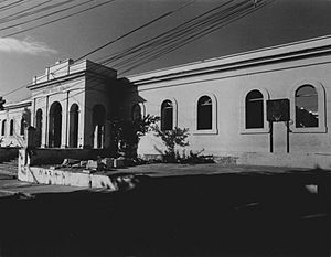
Barrio Sexto is home to an important historical building. This is the old Spanish Military Hospital. It is listed on the NRHP, which means it is a nationally recognized historic place.
Famous People from Sexto
- Pete "El Conde" Rodríguez was a singer, composer, and orchestra director. He was born in Sexto.
See also
 In Spanish: Sexto (Ponce) para niños
- List of communities in Puerto Rico
 | Valerie Thomas |
 | Frederick McKinley Jones |
 | George Edward Alcorn Jr. |
 | Thomas Mensah |


