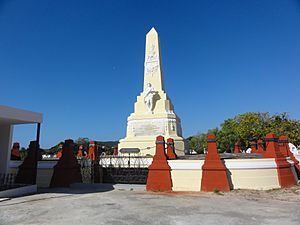
Portugués Urbano facts for kids
Quick facts for kids
Portugués Urbano
|
|
|---|---|
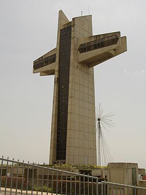
Cruceta del Vigía is a well-known landmark located in Barrio Portugues Urbano
|
|
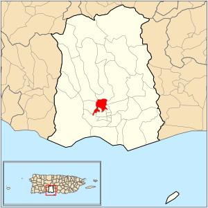
Location of barrio Portugues Urbano within the municipality of Ponce shown in red
|
|
| Commonwealth | |
| Municipality | |
| Area | |
| • Total | 1.26 sq mi (3.3 km2) |
| • Land | 1.26 sq mi (3.3 km2) |
| • Water | 0 sq mi (0 km2) |
| Elevation | 381 ft (116 m) |
| Population
(2010)
|
|
| • Total | 4,110 |
| • Density | 3,261.9/sq mi (1,259.4/km2) |
| Source: 2010 Census | |
| Time zone | UTC−4 (AST) |
Portugués Urbano is a neighborhood, or barrio, in the city of Ponce, Puerto Rico. It's one of 31 such areas in the municipality. This barrio was once a rural area but is now part of Ponce's urban zone. It was officially established in 1953.
Contents
Where is Portugués Urbano Located?
Portugués Urbano is an urban neighborhood found in the southern part of the municipality of Ponce. It is north of the historic downtown area but still within the city limits.
What are the Boundaries of Portugués Urbano?
This neighborhood has clear borders. To the north, it's bordered by Camino de Ponce (Golf Club) Street, Majagua Street, and Arboleda Street. To the south, you'll find Idilid Street, Shangai Street, Diez Street, Cinco Street, Pico Dulce Street, and Paseo de la Cruceta.
On the west side, its boundaries are Novedades Street, the hills east of Ponce Cement, and the future western part of PR-9. To the east, it's roughly bordered by Río Portugues, PR-503, Cayey Street, and Cerro San Tomas Street.
Portugués Urbano also shares borders with other neighborhoods. To its north is Portugués Rural. To the south, it borders Canas Urbano and Segundo. On the west, it's next to Magueyes Urbano, and to the east, it borders Machuelo Arriba and Sexto.
A Look at the History of Portugués Urbano
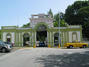
The Río Portugues (Portugués River) and the famous great Ceiba tree in Ponce have long been important to the area's first settlers. In the 1600s, the river marked the eastern edge of a growing settlement. This area eventually became known as Ponce.
The name "Barrio Portugués" first appeared in a list of Ponce's neighborhoods in 1824. This list was created by Pedro Tomás de Córdova. However, the name was mentioned in Ponce municipality records as early as September 1821. By 1822, Barrio Portugués was listed as one of the settlement's neighborhoods.
In 1878, a report by Manuel Ubeda y Delgado stated that Barrio Portugués had 155 families living in 33 houses and 100 bohios (simple huts). At that time, it was one of the least populated of Ponce's 22 neighborhoods. The report also mentioned "Quintana Baths," which were thermal baths located a bit over two kilometers northeast of the city. The old building that housed these baths can still be seen today on Puerto Rico Highway 503.
How Portugués Urbano Got Its Name
The name Hato de Portugués can be found in old land records from November 1800. Hatos were large areas of land used for raising cattle. They were the main land units in Puerto Rico until the late 1800s.
The name might be even older. Near the end of the 1500s, before Ponce became a village, a man named Don Pedro Rodríguez de Guzmán started a small community and a store. This was on the banks of the Río Baramaya. Rodríguez was one of the first people to settle in what is now Ponce. He was known as "El Portugués" (The Portuguese).
Some say he was from Portugal, while others say he was from San German but had Portuguese family. Historian Rafael Torrech San Inocencio explains that Rodríguez de Guzmán's store was likely at a river crossing. This was a place where people could easily cross the river on foot or horseback. Many old place names in Puerto Rico came from these important river crossings.
Over time, people might have started calling the Río Baramaya by the name Río Portugues. This unofficial name for the river might have then been used for the hato (cattle land) in that area. This is how today's Barrio Portugués might have gotten its name. As the city of Ponce grew, the urban part of Barrio Portugués was separated and named Barrio Portugués Urbano.
Facts and Figures About Portugués Urbano
The communities of Mameyes, El Vigia, and Jaime L. Drew are all located within Portugués Urbano.
In 2000, Portugués Urbano had about 1.14 square miles (2.95 square kilometers) of land. There was no water area. The population was 5,886 people, meaning there were about 5,163 people per square mile. The Mameyes landslide tragedy happened here.
By 2010, the land area was about 1.26 square miles (3.26 square kilometers), still with no water. The population had changed to 4,110 people. This meant there were about 3,261.9 people per square mile.
The highest point in Portugués Urbano is Cerro Ponce 2, which is 574 feet (175 meters) tall. Another important land feature is Cerro El Vigia, standing at 364 feet (111 meters).
The Mameyes Landslide Disaster
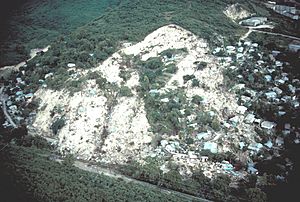
Portugués Urbano became widely known because of a sad event in 1985. Over 100 people were buried in their sleep due to a landslide. This happened in the Mameyes area of the barrio after very heavy rains.
On October 7, 1985, Ponce experienced a major tragedy. At least 129 people died in a mudslide in Mameyes. The heavy rains were part of the 1985 Puerto Rico floods. Help was needed from other countries to rescue people and recover bodies. The United States, Mexico, France, and Venezuela sent money, people, and equipment to help. After the disaster, the local government moved the remaining residents to new, safer homes in a different part of the municipality.
Famous Places to Visit
Portugués Urbano is home to two popular tourist spots: Serralles Castle and Cruceta El Vigía. Both are great places to visit.
See also
 In Spanish: Portugués Urbano para niños
- Tropical Storm Isabel (1985)
- List of communities in Puerto Rico
 | Jessica Watkins |
 | Robert Henry Lawrence Jr. |
 | Mae Jemison |
 | Sian Proctor |
 | Guion Bluford |


