
Canas Urbano facts for kids
Quick facts for kids
Canas Urbano
|
|
|---|---|
.jpg)
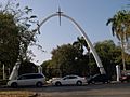
Scene in Barrio Canas Urbano at Avenida Las Américas, looking east, near Carretera Pámpanos
|
|

Location of barrio Canas Urbano within the municipality of Ponce shown in red
|
|

Canas Urbano
Location in Caribbean
|
|
| Commonwealth | |
| Municipality | |
| Area | |
| • Total | 2.31 sq mi (6.0 km2) |
| • Land | 2.31 sq mi (6.0 km2) |
| • Water | 0 sq mi (0 km2) |
| Elevation | 33 ft (10 m) |
| Population
(2010)
|
|
| • Total | 17,933 |
| • Density | 7,763.2/sq mi (2,997.4/km2) |
| Source: 2010 Census | |
| Time zone | UTC−4 (AST) |
Canas Urbano is a neighborhood, or "barrio," in the city of Ponce, Puerto Rico. It's one of 31 barrios in the area. Canas Urbano used to be a rural area, but now it's part of the city. Its name comes from the native people who lived there long ago. This barrio was officially created in 1953.
Contents
Where is Canas Urbano Located?
Canas Urbano is a city neighborhood in the southern part of Ponce, Puerto Rico. It's inside the city limits. You can find it southwest of the main city center, which is called Plaza Las Delicias.
What are the Boundaries of Canas Urbano?
Canas Urbano has clear boundaries that separate it from other areas. To the north, it's bordered by streets like Ponceña Street and PR-123. To the south, you'll find PR-2.
On the west side, the boundaries are generally PR-132, the Río Pastillo river, and the Rio Canas. To the east, it's bordered by Global Street and parts of the old Rio Portugues river.
Canas Urbano also shares borders with other barrios. To the north, it touches Magueyes Urbano, Portugués Urbano, Segundo, Primero, and Cuarto. To the south and west, it borders Canas and Playa. To the east, it's next to Segundo, Primero, and San Anton.

Size and Population of Canas Urbano
Canas Urbano covers about 2.3 square miles (6.0 square kilometers) of land. It doesn't have any water areas within its borders.
In the year 2000, about 21,482 people lived in Canas Urbano. This meant there were about 9,301 people living in every square mile. By 2010, the population had changed to 17,933 people. The density was then about 7,763.2 people per square mile.
Many communities are part of Canas Urbano. These include Jardines del Caribe, Morel Campos, Shanghai, Aristides Chavier, Baldorioty, San Antonio, Rio Canas, Los Maestros, Santa Maria, Perla del Sur, Villa Grillasca, and Reparto Universitario. Villa Grillasca was built in the 1950s and had 720 homes.
Important Places in Canas Urbano
Canas Urbano is home to several important landmarks:
- The Juan Pachín Vicéns Auditorium is a large arena often used for sports and events.
- The Francisco Montaner Stadium is a sports stadium.
- The Pontifical Catholic University of Puerto Rico is a major university.
Gallery
-
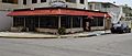
Italian restaurant on Calle Concordia, near Avenida Las Américas
-
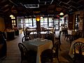
Italian restaurant on Calle Concordia near Avenida Las Américas
-
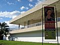
Museo de Arte de Ponce, on Avenida Las Américas
-
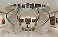
Interior of Museo de Arte de Ponce on Avenida Las Américas
-
Universidad Católica on Avenida Las Américas
-
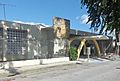
Ponce YMCA Building in Urbanización Santa María
.jpg)
.jpg)
.jpg)

.jpg)

See also
 In Spanish: Canas Urbano para niños
- List of communities in Puerto Rico
