Mackenzie County facts for kids
Quick facts for kids
Mackenzie County
|
||
|---|---|---|
|
Specialized municipality
|
||

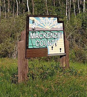
Welcome sign
|
||
|
||

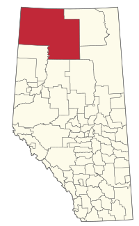
Location within Alberta
|
||
| Country | Canada | |
| Province | Alberta | |
| Region | Northern Alberta | |
| Planning region | Lower Peace | |
| Incorporated - Municipal district |
January 1, 1995 |
|
| - Specialized municipality | June 23, 1999 | |
| Name change | March 8, 2007 | |
| Area
(2021)
|
||
| • Land | 79,629.26 km2 (30,745.03 sq mi) | |
| Population
(2021)
|
||
| • Total | 12,804 | |
| • Density | 0.2/km2 (0.5/sq mi) | |
| • Municipal census (2018) | 12,514 | |
| Time zone | UTC−7 (MST) | |
| • Summer (DST) | UTC−6 (MDT) | |
| Website | mackenziecounty.com | |
Mackenzie County is a very large area in northern Alberta, Canada. It's known as a "specialized municipality" because it has many different kinds of communities spread across a huge territory. Its main office is in a place called Fort Vermilion.
Contents
The Story of Mackenzie County
Mackenzie County started as something called Improvement District No. 23. This was a way to manage land before it became a full municipality. On January 1, 1995, it officially became a municipal district.
Just a few years later, on June 23, 1999, it changed its status to a "specialized municipality." This change happened because the area is so big and has many unique communities. It helped the local government manage things better. On March 8, 2007, its name officially became Mackenzie County.
Exploring the Geography of Mackenzie County
Mackenzie County is located in the very northwest corner of Alberta. It shares borders with British Columbia to the west and the Northwest Territories to the north. To the east, it borders Wood Buffalo National Park, which is a huge protected area.
The Peace River flows eastward through the southern part of the county. There are also several lakes, including Bistcho Lake, Eva Lake, and Zama Lake. You can find different land formations here too, like the Caribou Mountains in the northeast and the Buffalo Head Hills in the south.
Towns and Hamlets in Mackenzie County
Mackenzie County surrounds two main towns:
- High Level
- Rainbow Lake
Within Mackenzie County itself, there are several hamlets. A hamlet is a small community that is part of a larger municipality. Some of these include:
- Fort Vermilion (where the county office is)
- La Crete
- Zama City
Understanding Mackenzie County's Population
|
||||||||||||||||||||||||||||||
Every few years, Statistics Canada counts how many people live in different areas. This is called a census. In the 2021 Census, Mackenzie County had 12,804 people living there. This was a good increase from its population of 11,171 in 2016.
Because Mackenzie County is so large (about 79,629 square kilometers), the population is very spread out. This means there aren't many people living in each square kilometer.
Fun Places to Visit in Mackenzie County
Mackenzie County is home to some amazing natural areas. You can explore Caribou Mountains Wildland Provincial Park and Hay-Zama Lakes Wildland Provincial Park. These parks are great places to see wildlife and enjoy nature. The county is also right next to Wood Buffalo National Park to the east, which is one of the largest national parks in the world!
 | William L. Dawson |
 | W. E. B. Du Bois |
 | Harry Belafonte |


