Mahone Bay facts for kids
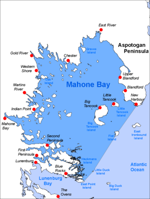
Mahone Bay is a lovely bay located on the Atlantic coast of Nova Scotia, Canada. It's found at the eastern end of Lunenburg County. This bay is famous for its many islands, making it a very popular spot for sailing. Since 2003, the Mahone Islands Conservation Association has been working hard to protect the bay's natural environment. The bay and its islands have many different natural areas, like forests, rocky shores, sandy beaches, wetlands, and mudflats. You can find lots of wildlife here, including birds like black guillemots, eagles, osprey, leach's storm petrels, puffins, razorbills, and great blue herons.
History of Mahone Bay
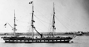
The land around Mahone Bay was first home to the Mi'kmaq people, who are indigenous to the area. Later, French explorers were the first Europeans to arrive. On their early maps, they called the bay La Baye de Toutes Iles, which means "The Bay of Many Islands." The name "Mahone" comes from the French word mahonne, which was a type of flat-bottomed boat or barge.
In 1754, the British brought German-speaking settlers from Europe to live in this area, starting in Lunenburg. For many years, German was the main language spoken here. Even today, in the Bayview Cemetery, you can see old gravestones from the late 1700s with names like Zwicker, Eisenhauer, Heyson, and Kedy written in German.
Mahone Bay was also a place where conflicts happened during the French and Indian War and the War of 1812.
In the mid-1800s, people in the area were busy with activities like cutting down trees (forestry), building ships, trading goods by sea (shipping), and farming. These activities helped the community grow, leading to the building of churches and schools. In 1903, a train line was built, connecting the area to Halifax. The town of Mahone Bay officially became a town in 1919.
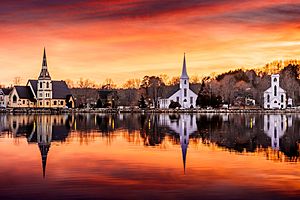
Today, the main way people make a living in Mahone Bay is through tourism. Many visitors come to enjoy its beauty.
Geography of Mahone Bay
Mahone Bay opens directly south into the Atlantic Ocean. Its eastern side is formed by the Aspotogan Peninsula, and its western side is formed by the First Peninsula (which is part of Lunenburg). The Chester Peninsula also extends several kilometers into the bay.
The land around Mahone Bay is different from its neighbor, St. Margarets Bay. Mahone Bay has a wider variety of soils and rocks. Many small hills, called drumlins, were formed by glaciers on the western shore near the towns of Mahone Bay and Lunenburg. These drumlins have created good soil for small farms.
Mahone Bay is also unique because it has countless small and medium-sized islands scattered throughout its waters. These islands offer protection from the wind, and along with the summer breezes, they make the scenery around Mahone Bay very appealing to tourists. Today, the towns of Chester and Mahone Bay are popular places for people who enjoy sailing in pleasure yachts. There's also a scenic provincial park at Graves Island, just east of Chester, which is a favorite spot for camping.
Mahone Bay is home to many charming fishing communities. Some of the most well-known are Big Tancook and Little Tancook, located on Big Tancook Island and Little Tancook Island. Other important fishing villages include Blandford.
 | Dorothy Vaughan |
 | Charles Henry Turner |
 | Hildrus Poindexter |
 | Henry Cecil McBay |


