Maiden Way facts for kids
The Maiden Way was an important Roman road in ancient Britain. It was about 32 kilometers (20 miles) long. This road connected two important Roman forts. One fort was called Bravoniacum (near modern-day Kirkby Thore). The other was Magnae (near Carvoran) on Hadrian's Wall.
About halfway between these two forts was another fort called Epiacum (now known as Whitley Castle). The Maiden Way helped connect these Roman strongholds.
Contents
What Was the Maiden Way?
The Maiden Way was a key part of the Roman transport network. It helped the Roman army move soldiers and supplies. This road was built to be strong and straight. It made travel much faster in Roman times.
Connecting Roman Forts
The road linked Bravoniacum, a fort near Penrith, to Magnae, a fort right on Hadrian's Wall. Hadrian's Wall was a huge barrier built by the Romans. It protected the northern border of their empire.
The fort at Epiacum was also very important. It was located near lead and silver mines. The Maiden Way helped transport these valuable metals.
Why Was It Important?
The Maiden Way acted like a shortcut. It helped supply the central and eastern parts of Hadrian's Wall. This meant food, weapons, and other goods could reach the soldiers quickly. It was a vital supply route for the Roman army.
Discovering More About the Road
In 2016, new discoveries were made about the Maiden Way. Scientists used a special technology called LIDAR. LIDAR uses lasers to create detailed maps of the ground. It can even show things hidden underground.
This technology helped find more parts of the Maiden Way. It showed that the road continued south from Kirkby Thore. It went all the way to another Roman fort at Low Borrowbridge, near Tebay. This discovery helped us understand the full length of this ancient road.
The Maiden Way After the Romans
The Roman Empire eventually left Britain. But the Maiden Way continued to be used. For many years, it became a drovers' road. This means people used it to move large groups of animals, like sheep and cattle. They would drive the animals from one place to another for trade.
The name "Maiden Way" might come from a small fort called Maiden Castle. This fort guarded the Stainmore Pass. This pass was an important route to the east of the fort of Verterae (modern-day Brough).
The Maiden Way Today
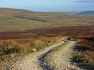
Today, parts of the Maiden Way can still be seen. The famous Pennine Way footpath follows the old Roman road for several miles. This is in Northumberland, near the South Tyne river.
A modern minor road also follows the line of the Maiden Way. This road is west of Featherstone Castle. So, even after thousands of years, the path of the Maiden Way is still used and explored. It reminds us of the amazing engineering of the Romans.
 | Frances Mary Albrier |
 | Whitney Young |
 | Muhammad Ali |


