Mairangi Bay facts for kids
Quick facts for kids
Mairangi Bay
|
|
|---|---|
|
Suburb
|
|
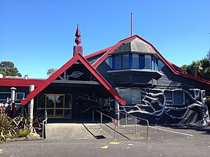
Mairangi Arts Centre
|
|
| Country | New Zealand |
| Local authority | Auckland |
| Electoral ward | Albany ward |
| Local board | Hibiscus and Bays |
| Area | |
| • Land | 173 ha (427 acre) |
| Population
(June 2023)
|
|
| • Total | 6,060 |
|
|
||
Mairangi Bay (which in Māori is called Te Whanga o Oho Mairangi) is a lovely coastal suburb in Auckland, New Zealand. It sits on the northern side of the Waitematā Harbour. This area used to be governed by the North Shore City Council. However, in 2010, it became part of the larger Auckland Council.
Contents
Exploring Mairangi Bay's Nature
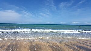
Mairangi Bay is found along the beautiful East Coast Bays of the North Shore. It's located right between two other bays: Murrays Bay to the north and Campbells Bay to the south. The bay itself, facing east, shares the same name as the suburb.
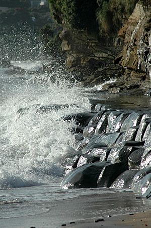
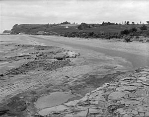
The land here is mostly made of clay and a type of rock called Waitemata sandstone. You can easily see this sandstone in the cliffs along the coast. Long ago, before people settled here, Mairangi Bay was covered in thick forests. These forests had tall trees like tōtara, mataī, miro, kauri, and kahikatea. Along the coastline, bright red pōhutukawa trees were a common sight.
A Glimpse into the Past
Māori History of Mairangi Bay
Māori people first settled in the Auckland Region a very long time ago, around the 13th or 14th centuries. The North Shore was home to Tāmaki Māori tribes. These groups included people whose ancestors arrived on the Tainui canoe.
Even though the soil wasn't great for farming, Māori found plenty of food here. They gathered fish, shellfish, and marine birds. They also grew kūmara (sweet potatoes) in Mairangi Bay. The traditional Māori name for this coast, between Murrays Bay and Campbells Bay, is Waipapa. The name Mairangi Bay comes from an older Māori place name, Ōmairangi. This name refers to an important ancestor named Mairangi.
Around the 17th century, a warrior named Maki came to the Auckland Region. He united many Tāmaki Māori tribes, forming a group called Te Kawerau ā Maki. After Maki passed away, his sons created new family groups (hapū) in different areas. His younger son, Maraeariki, settled the North Shore and Hibiscus Coast.
Maraeariki's daughter, Kahu, became a leader after him. The North Shore is even named after her: Te Whenua Roa o Kahu, meaning "The Greater Lands of Kahu." Many of the local tribes, like Ngāti Manuhiri and Ngāi Tai Ki Tāmaki, can trace their family lines back to Kahu.
By the 18th century, another powerful tribe, Ngāti Paoa, had spread their influence. They controlled islands in the Hauraki Gulf and parts of the North Shore. Peace was made between tribes by the 1790s. When Europeans first arrived in the late 1700s, many Māori sadly died from new diseases. In the early 1820s, most Māori living on the North Shore moved away. This was because of the danger from war parties during the Musket Wars. However, most people had returned to their homes by the late 1820s and 1830s.
European Settlement and Growth
In 1841, the government bought a large area of land. This land stretched from Takapuna to Te Ārai. Some Māori tribes agreed to this sale, but others who also had rights to the land were not included. It took until 1873 for the government to fix this by making more agreements with all the groups involved.
In 1880, an English settler named Thomas Murray bought the land. He turned the wild scrubland into a farm for sheep and cattle. He also grew crops like corn and wheat. Murray was a very religious man who taught Sunday school. His farm grew to be quite large. The bay became known as Little Murrays Bay, to tell it apart from Murrays Bay to the north. Murray also sold kauri gum and grew fruit to sell in Auckland.
After Murrays Bay was officially named in 1900, locals wanted a new name for Little Murrays Bay. They chose Mairangi Bay, based on the Māori name Ōmairangi. The land was then divided up and sold in 1912.
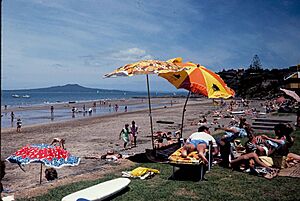
When the Murrays Bay Wharf was built in 1916, Mairangi Bay became a popular spot. People from Auckland would come by ferry for holidays or day trips. More houses were built in the 1920s, often as holiday homes. The Mairangi Bay post office opened in 1930. Shops and local services started appearing in the 1930s and 1940s.
During World War II, small concrete bunkers called pillboxes were built in Mairangi Bay. These were placed at the beach, on the cliffs, and even near the modern-day Mairangi Bay School. A searchlight was also set up to watch for enemy ships.
After the Auckland Harbour Bridge opened in 1959, Mairangi Bay grew even more. It became a popular place for families to live. The shops in Mairangi Bay were the first in the area to open on Saturdays. The Mairangi War Memorial Hall was built in 1953 as a community center. In 1956, a new high school opened, which later became Rangitoto College. This school is now the largest high school in New Zealand. In 1966, the first supermarket in the East Coast Bays was built in Mairangi Bay.
In 1991, the War Memorial Hall was updated and became the Mairangi Arts Centre. Since 2004, work has been done to improve how stormwater is managed in Mairangi Bay and nearby beaches.
Mairangi Bay Today
Mairangi Bay covers about 1.73 square kilometers. In 2023, it had an estimated population of about 5,646 people. The population has slowly grown over the years. For example, in 2018, there were 5,646 people living here.
Most people living in Mairangi Bay are of European descent. There are also significant numbers of Asian, Māori, and Pacific peoples. Many residents were born overseas, showing the diverse nature of the community.
When it comes to jobs, about 48.7% of people aged 15 and over work full-time. Many residents also have a bachelor's degree or higher education.
Learning and Fun in Mairangi Bay
Mairangi Bay has two primary schools for younger students (Years 1-6). Mairangi Bay School opened in 1967. St John's School is a Catholic school that started in 1961. For older students, Rangitoto College is a very large secondary school located nearby in Windsor Park.
There's a popular walking path that goes along the coast of Mairangi Bay. You can walk from Campbells Bay all the way to Browns Bay. This path lets you see the interesting sandstone cliffs up close.
 | James Van Der Zee |
 | Alma Thomas |
 | Ellis Wilson |
 | Margaret Taylor-Burroughs |


