Murrays Bay facts for kids
Quick facts for kids
Murrays Bay
|
|
|---|---|
|
Suburb
|
|

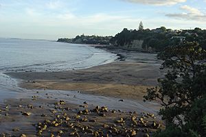
Looking down on Murrays Bay beach at low tide
|
|
| Country | New Zealand |
| Local authority | Auckland |
| Electoral ward | Albany ward |
| Local board | Hibiscus and Bays |
| Established | 1880 |
| Area | |
| • Land | 166 ha (410 acre) |
| Population
(June 2023)
|
|
| • Total | 4,960 |
| Postcode(s) |
0630
|
|
|
||
Murrays Bay is a small neighbourhood located in the East Coast Bays area of Auckland, New Zealand. It's part of the North Shore and is about the same size as Rothesay Bay, which is just to its north.
Murrays Bay is mostly a place where people live. However, it also has a community centre, a restaurant, and a café. Buses regularly connect Murrays Bay to Takapuna and the Auckland city centre.
Contents
Murrays Bay's Location and Landscape
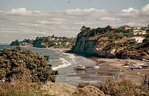
Murrays Bay is found on the North Shore's East Coast. It sits between Rothesay Bay to the north and Mairangi Bay to the south. The bay itself is nestled between Tatarata Point, a piece of land sticking out to the east, and Mairangi Bay. A small stream called Taiorahi Creek flows through the area and into the bay.
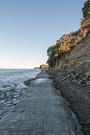
The land here is mostly made of clay and a type of rock called Waitemata sandstone. You can see this sandstone in the cliffs along the coast.
Plants and Trees of Murrays Bay
Before people settled here, the inland areas of Murrays Bay were covered in thick forests. These forests had tall trees like tōtara, mataī, miro, kauri, and kahikatea. Along the coastline, beautiful pōhutukawa trees were very common. Later, in the 1800s, the area was mostly covered in mānuka bushes and harakeke flax.
Murrays Bay's Past
Early Māori History
Māori people first came to the Auckland Region around the 13th or 14th centuries. The North Shore was settled by Tāmaki Māori tribes. These included people whose ancestors arrived on the Tainui canoe. Many Tāmaki Māori on the North Shore were known as Ngā Oho.
Even though the soil wasn't great for farming, the area offered good resources. People could find fish, shellfish, and seabirds. The traditional name for the coast between Murrays Bay and Campbells Bay is Waipapa.
A warrior named Maki traveled from the Kāwhia Harbour to his family's lands in Auckland. This was likely in the 1600s. Maki brought together many Tāmaki Māori tribes, forming Te Kawerau ā Maki. This included the tribes on the North Shore.
After Maki passed away, his sons settled in different parts of his lands. This created new family groups called hapū. His younger son, Maraeariki, settled the North Shore and Hibiscus Coast. His daughter, Kahu, took over after him. The North Shore is named after her: Te Whenua Roa o Kahu, meaning "The Greater Lands of Kahu." Many of the local tribes, like Ngāti Manuhiri and Ngāi Tai Ki Tāmaki, can trace their family lines back to Kahu.
By the 1700s, the Marutūāhu tribe Ngāti Paoa had become very powerful. They controlled the islands of the Hauraki Gulf and the North Shore. After some fighting, peace was made by the 1790s.
Europeans started arriving in the late 1700s. This brought new diseases, like rewharewha (respiratory illnesses), which sadly caused many Māori to die. In the early 1820s, most Māori on the North Shore left their homes. They went to the Waikato or Northland to escape the Musket Wars. Most people returned by the late 1820s and 1830s.
European Settlement and Growth
In 1841, the Crown bought a large area of land, including Murrays Bay. This purchase involved some Māori tribes but not all of them. It took until 1873 for the government to sort out all the land deals.
The first Europeans in Murrays Bay were people who dug for kauri gum in the mid-1800s. Murrays Bay had one of the biggest gum digger camps on the North Shore. The area was first known as Tommy's Bay, named after the Māori landowner.
In 1880, an English settler named Thomas Murray bought the land. He was from Newcastle upon Tyne. He turned the mānuka and harakeke scrubland into a farm for sheep and cattle. He also grew crops like corn and wheat. Murray was a Christian and taught Sunday school. His farm grew to 174 acres, and the bay became known as Big Murrays Bay. (Little Murrays Bay was the name for Mairangi Bay to the south). Murray also sold kauri gum and grew fruit to sell in Auckland.
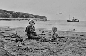
In 1910, the name changed from Big Murrays Bay to simply Murrays Bay. The land was divided up and sold in 1912. After the Murrays Bay Wharf was built in 1916, the area became a popular holiday spot. People from Auckland would visit by ferry for day trips or holidays.
Houses started to be built after 1912, but construction stopped for five years because of World War I. By 1920, holiday homes were built, and by 1926, two shops had opened. In the 1930s, Murrays Bay was a safe place for children during a polio outbreak. During World War II, small concrete shelters called pillboxes were built at the beach and on the cliffs to protect the coast.
Murrays Bay grew a lot in the 1950s after World War II. In 1956, a new high school opened, called Murray's Bay High School. This school later became Rangitoto College, which is now the largest high school in New Zealand. The Murrays Bay Sailing Club started in 1958, and a new wharf replaced the old one in 1973.
Murrays Bay Today
Murrays Bay covers about 1.66 square kilometres. As of 2023, it has an estimated population of about 4,764 people.
In the 2018 census, there were 1,554 households. The population included 2,322 males and 2,442 females. About 18.2% of the people were under 15 years old.
Many different cultures live in Murrays Bay. About 71.2% of people were European/Pākehā, 4.3% Māori, and 25.8% Asian. About 45.4% of people were born overseas.
Things to Do in Murrays Bay
A popular public walkway goes along the coast of Murrays Bay. It connects Campbells Bay to Browns Bay further north. Along this path, you can see sections of the exposed Waitemata sandstone cliffs.
Murrays Bay beach has a wharf where people enjoy jumping off and fishing, especially in spring and summer. There is also a sailing club that regularly sails from the beach.
Schools in Murrays Bay
Murrays Bay has two main schools:
- Murrays Bay School is a primary school for students in years 1 to 6. It has about 700 students.
- Murrays Bay Intermediate is for students in years 7 and 8. It has about 600 students and opened in 1958.
Both schools are for both boys and girls and are known for being high-achieving schools. They share the same site and were established in 1957 and 1958.
 | Emma Amos |
 | Edward Mitchell Bannister |
 | Larry D. Alexander |
 | Ernie Barnes |


