Mandeville Island facts for kids

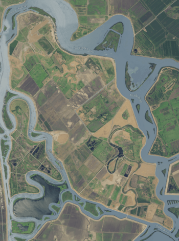
USGS aerial imagery of the island.
|
|
| Geography | |
|---|---|
| Location | Northern California |
| Coordinates | 38°02′05″N 121°32′56″W / 38.03472°N 121.54889°W |
| Adjacent bodies of water | Sacramento-San Joaquin River Delta |
| Area | 5,500 acres (2,200 ha) |
| Administration | |
|
United States
|
|
| State | California |
| County | San Joaquin |

Mandeville Island is an island located in the Sacramento–San Joaquin Delta in central California, United States. It's about 15 miles (24 km) northwest of Stockton. The island is a part of San Joaquin County.
Contents
About Mandeville Island
Mandeville Island is a large piece of land surrounded by water. It's an important part of the Sacramento-San Joaquin Delta. This area is a network of rivers and channels.
Where is Mandeville Island?
The island sits between two important waterways. To its west is the Old River. To its east is the Middle River. Both of these are smaller channels that branch off from the San Joaquin River. These branching channels are called distributaries.
The southern edge of Mandeville Island is formed by the Connection Slough. To the north, the Sand Mound Slough borders the island. Right next to Mandeville Island, to its east, is the Franks Tract State Recreation Area.
How Big is Mandeville Island?
Mandeville Island covers a large area. It is about 5,500 acres (2,200 ha) in size. To give you an idea, that's like having over 4,000 football fields! The island is managed by a group called Reclamation District 2027. This group helps manage the land and water in the area.
Understanding the Sacramento-San Joaquin Delta
Mandeville Island is located within the huge Sacramento-San Joaquin Delta. This delta is a very special place in California. It's where the Sacramento and San Joaquin Rivers meet. Then, they flow into San Francisco Bay.
What is a Delta?
A delta is a low, watery land area. It forms at the mouth of a river. This happens when the river slows down and drops its sediment. Over time, this sediment builds up. It creates many small islands and channels. The Sacramento-San Joaquin Delta is one of the largest in the western United States.
Why is the Delta Important?
The Delta is super important for many reasons:
- Water Supply: It provides drinking water for millions of Californians. It also supplies water for farms.
- Wildlife Habitat: It's home to many different animals. This includes fish, birds, and other creatures. Some of these species are rare or endangered.
- Recreation: People love to visit the Delta for fun activities. They enjoy boating, fishing, and birdwatching.
The Delta's unique mix of land and water makes it a vital natural resource.
 | Selma Burke |
 | Pauline Powell Burns |
 | Frederick J. Brown |
 | Robert Blackburn |


