Marine Corps Base Hawaii facts for kids
Quick facts for kids Marine Corps Base Hawaii |
|
|---|---|
| Mokapu Peninsula, Oahu, Hawaiʻi | |
Marine Corps Base Hawaii insignia
|
|
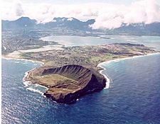
Aerial photograph of Marine Corps Base Hawaii
|
|
| Coordinates | 21°26′37″N 157°44′56″W / 21.443611°N 157.748889°W |
| Type | Military base |
| Site information | |
| Controlled by | United States Marine Corps |
| Site history | |
| Built | 1919 |
| Built by | United States Army United States Navy |
| In use |
|
| Battles/wars | Pacific War |
| Events | Winter White House |
| Garrison information | |
| Past commanders |
Col. Raul Lianez |
| Garrison | 3rd Marine Regiment Marine Aircraft Group 24 Combat Logistics Battalion 3 3rd Radio Battalion Commander, Patrol and Reconnaissance Wing 2 (US Navy) |
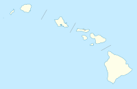
Marine Corps Base Hawaii (MCBH) is a special place for the U.S. Marines. It is located on the Mokapu Peninsula in O'ahu, Hawaiʻi. This base is home to Marines, Sailors, their families, and many civilian workers.
MCBH has a long runway that is about 7,800-foot (2,400 m) long. It is used by different military aircraft. The base is also home to important Marine and Navy units. These include the 3rd Marine Littoral Regiment and Marine Aircraft Group 24.
The base is found between the towns of Kailua and Kāne'ohe. It is about 12 miles (19 km) northeast of Honolulu. The entire Mokapu Peninsula is part of the base, covering about 2,951 acres (1,194 ha; 11.94 km2). Some parts of the base are even protected as conservation land.
Contents
History of the Base
The story of Marine Corps Base Hawaii began in 1918. That year, President Woodrow Wilson set aside 322 acres (130 ha; 1.30 km2) of land on Mokapu Peninsula for the military. This area was first known as the Kuwaahoe Military Reservation. Later, in 1942, it became Fort Hase.
In 1939, the United States Navy built a small base for seaplanes there. By 1941, United States Army artillery units also moved into the area. The base was then called Naval Air Station Kaneohe Bay. It helped protect the Kaneohe Bay area.
Attack on Pearl Harbor
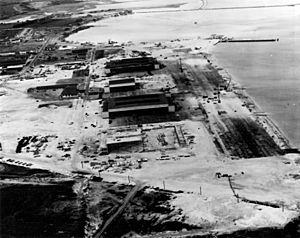
On December 7, 1941, Naval Air Station Kaneohe Bay was attacked. This happened about 9 minutes before the famous attack on Pearl Harbor. The brave gunners at the base fought back. They shot down three enemy airplanes. Two of these planes crashed into Kaneohe Bay. Another crashed near Radar Hill, where a memorial now stands for the pilot who died.
After World War II
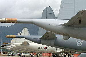
In 1951, the Marines took over the air station. The Navy's planes moved to a different base. On January 15, 1952, the base was officially named Marine Corps Air Station Kaneohe Bay.
Later, on April 15, 1994, all the Marine Corps bases in Hawaii were combined. Marine Corps Air Station Kaneohe Bay, along with other smaller sites, became one big command. This new command was named Marine Corps Base Hawaii. Its main office is at MCBH Kaneohe Bay.
All U.S. military groups in Hawaii are part of the USINDOPACOM. This command is based at Camp H. M. Smith on Oahu. The leader of the Marine Forces Pacific also oversees 12 Marine Corps bases. These bases are in places like Arizona, California, Hawaii, and Japan.
In 2010, parts of the movie Battleship were filmed at MCBH.
Recent Incidents
On November 20, 2023, a P-8A Poseidon plane from the US Navy tried to land. It was raining, and it was hard to see. The plane could not stop and went past the end of the runway. It ended up in Kāneʻohe Bay. All nine people on board were rescued safely by US Coast Guard boats. The plane was from Patrol Squadron 4.
Geography of the Base
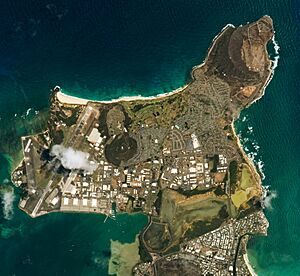
Marine Corps Base Hawaii covers about 5.8 square miles (15 km2). Most of this area is land, but about 1.4 square miles (3.6 km2) is water. The base has two large volcanic hills. One is called Radar Hill, which is 646 feet (197 m) tall. It used to have a radar station. The other is Ulapau Crater, which is 659 feet (201 m) tall and looks over the base.
People Living at the Base
|
Kaneohe Base CDP
|
|
|---|---|
 |
|
| Country | United States |
| State | Hawaii |
| County | Honolulu |
| Elevation | 7 ft (2 m) |
| Time zone | UTC−6 (Central (CST)) |
| • Summer (DST) | UTC−5 (CDT) |
| GNIS feature ID | 2414064 |
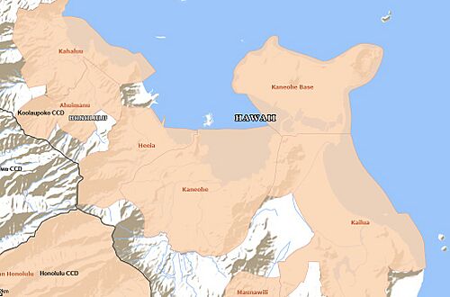
For counting purposes, the area is called the Kaneohe Base census-designated place (CDP). In 2020, about 9,483 people lived there. This area was once known as Kaneohe Station.
| Historical population | |||
|---|---|---|---|
| Census | Pop. | %± | |
| 2000 | 11,827 | — | |
| 2010 | 9,517 | −19.5% | |
| 2020 | 9,483 | −0.4% | |
| U.S. Decennial Census 2010 2020 listed as Kaneohe Station in 2010 |
|||
Education at MCBH
The Hawaii Department of Education runs Mokapu Elementary School. This school is located right on the MCBH property. It teaches students from kindergarten up to 6th grade. In 2020, about 900 students attended Mokapu Elementary. This made it the largest school on the Windward side of Oahu.
Green Energy at the Base
Since 2004, MCBH has been working on ways to create clean energy. They teamed up with Ocean Power Technologies to test making electricity from ocean waves. They use a special device called a "PowerBuoy" wave energy converter. This was one of the first projects in the U.S. to use wave power.
Another wave power device called Azura is also being tested at the base. It is placed in the ocean at a depth of 30 metres (98 ft).
Marine Corps Base Hawaii is also working to be more "green." They have put solar water heaters on all homes on the base. They also have a "Net Zero" home that uses only solar power. Many of the base's vehicles are now hybrid or electric. Other vehicles use E85, which is a fuel made from ethanol. In 2010, MCB Hawaii was the first U.S. military base to have an E85 fuel pump.
See also
 In Spanish: Base del Cuerpo de Marines de Hawaii para niños
 | May Edward Chinn |
 | Rebecca Cole |
 | Alexa Canady |
 | Dorothy Lavinia Brown |


