Marquette River facts for kids
Quick facts for kids Marquette |
|
|---|---|

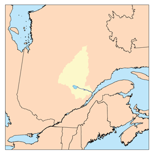
Watershed of Saguenay River
|
|
| Country | Canada |
| Province | Quebec |
| Region | Saguenay-Lac-Saint-Jean |
| Physical characteristics | |
| Main source | Marquette Lake Lac-Ashuapmushuan, Quebec, Le Domaine-du-Roy (RCM), Saguenay-Lac-Saint-Jean, Quebec 411 m (1,348 ft) 48°57′25″N 73°56′13″W / 48.95694°N 73.93694°W |
| River mouth | Ashuapmushuan Lake Lac-Ashuapmushuan, Quebec, Le Domaine-du-Roy (RCM), Saguenay-Lac-Saint-Jean, Quebec 371 m (1,217 ft) 49°11′24″N 73°47′48″W / 49.19000°N 73.79667°W |
| Length | 64.9 km (40.3 mi) |
| Basin features | |
| Tributaries |
|
The Marquette River is a river in Quebec, Canada. It flows into Ashuapmushuan Lake. This river is located in the Saguenay-Lac-Saint-Jean region, specifically in the area called Lac-Ashuapmushuan, Quebec.
The river flows through different areas, including the Ashuapmushuan Wildlife Reserve. The main activity in this river valley is forestry, which means cutting down trees. Tourism and recreation, like fishing or boating, are also popular.
A forest road (R0212) crosses the upper part of the Marquette River. Another main road, Route 167, runs near the river and Ashuapmushuan Lake.
The Marquette River usually freezes over in early November and stays frozen until mid-May. It's generally safe to walk on the ice from mid-November to mid-April.
Where Does the Marquette River Flow?
The Marquette River is about 64.9 kilometres (40.3 mi) (about 40 miles) long. It starts at Marquette Lake, which is 411 metres (1,348 ft) (about 1,348 feet) above sea level. This lake is fed by several smaller lakes.
The river flows through different townships:
- First, it goes north, northeast, and then northwest for about 25.4 kilometres (15.8 mi) (15.8 miles). It forms small streams and goes through marshy areas.
- Then, it flows northwest for about 18.4 kilometres (11.4 mi) (11.4 miles). Here, it meets the Marquette River West.
- Next, it goes northeast for about 15.7 kilometres (9.8 mi) (9.8 miles), making a loop to the south.
- Finally, it flows southeast for about 4.0 kilometres (2.5 mi) (2.5 miles) before reaching its mouth.
The Marquette River empties into a bay on the northwestern side of Ashuapmushuan Lake. From there, the water flows into the Ashuapmushuan River, which eventually reaches Lac Saint-Jean.
Neighboring Rivers and Lakes
The areas next to the Marquette River have many other bodies of water:
- To the north: Normandin River, Ashuapmushuan Lake, Ashuapmushuan River.
- To the east: Harlequin Creek, Ashuapmushuan Lake, Licorne River.
- To the south: Marquette Lake, Loup River West (Ashuapmushuan Lake).
- To the west: Poutrincourt Lake, Normandin River, Milieu River (Normandin River), Frontenac Lake (Milieu River).
The Name of the Marquette River
The name "Marquette River" honors a famous explorer named Jacques Marquette. He was a Jesuit missionary who lived from 1637 to 1675.
Jacques Marquette was very important in exploring North America.
- He learned Native American languages.
- In 1671, he started a mission called Saint-Ignace for the Wendat (Hurons) people.
- In 1672, he met Louis Jolliet. Together, they explored the Mississippi River, going as far as what is now the border of Arkansas and Louisiana.
- He wanted to start another mission, but he became ill.
The name "Rivière Marquette" was officially recognized on December 5, 1968, by the Commission de toponymie du Québec, which is the organization in Quebec that names places.
 | Kyle Baker |
 | Joseph Yoakum |
 | Laura Wheeler Waring |
 | Henry Ossawa Tanner |

