Frontenac Lake (Milieu River) facts for kids
Quick facts for kids Frontenac Lake |
|
|---|---|

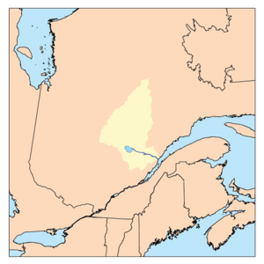
Watershed of Saguenay River
|
|
| Location | Le Domaine-du-Roy (RCM) |
| Coordinates | 48°56′32″N 74°07′04″W / 48.94222°N 74.11778°W |
| Type | Natural |
| Primary inflows |
|
| Primary outflows | Poutrincourt Lake, Milieu River (Normandin River) |
| Basin countries | Canada |
| Max. length | 6.6 kilometres (4.1 mi) |
| Max. width | 1.9 kilometres (1.2 mi) |
| Surface elevation | 427 metres (1,401 ft) |
Frontenac Lake is a freshwater lake located in the Lac-Ashuapmushuan, Quebec unorganized territory. This means it's a large area of land in Quebec, Canada, that doesn't have its own local government. The lake is in the northwestern part of the Le Domaine-du-Roy region, which is part of Saguenay-Lac-Saint-Jean.
The main activity in this area is forestry, which means growing and harvesting trees. After forestry, recreational tourism is also important. People come here to enjoy nature and outdoor activities.
Forest roads help people get around. Road R0212 crosses the Milieu River. Another road, R0223, goes through the valley of the Marquette River West. This road connects to Route 167, which links the towns of Chibougamau and Saint-Félicien, Quebec. The Canadian National Railway also runs along Route 167.
Lake Frontenac usually freezes over from early November until mid-May. However, it's safest to walk or play on the ice from mid-November to mid-April.
About Frontenac Lake
Frontenac Lake is about 6.6 kilometres (4.1 mi) long and 1.9 kilometres (1.2 mi) wide. It sits at an elevation of 427 metres (1,401 ft) above sea level. One interesting feature is a long piece of land, called a peninsula, that sticks out from the west side of the lake. It stretches for about 1.1 kilometres (0.68 mi) towards the center of the lake. The northern part of the lake looks a bit like a hockey stick!
Rivers and Water Flow
The water from Lake Frontenac flows out into the Milieu River. This river then joins Poutrincourt Lake. From Poutrincourt Lake, the water continues to flow north into the Normandin River.
Here are some of the main rivers and lakes connected to Frontenac Lake:
- To the North: Milieu River, Ressaut Lake, Poutrincourt Lake, and Normandin River.
- To the East: Palluau Lake, Maskoskanaw River, Marquette River, and Ashuapmushuan River.
- To the South: Galinée Lake, Patterson Lake, Maskoskanaw River, Berlinguet Lake, and Berlinguet Creek.
- To the West: Secondat Lake, Little Buade Lake, Normandin Lake (Normandin River), and Normandin River.
The Maskoskanaw River flows into a bay on the east side of Lake Frontenac. From there, the water travels north through the Milieu River to Poutrincourt Lake. The water then crosses Poutrincourt Lake and continues north.
Eventually, the water from these lakes and rivers flows into Nicabau Lake. From Nicabau Lake, the water travels along the Normandin River until it reaches Ashuapmushuan Lake. Finally, the water flows through the Ashuapmushuan River all the way to Lac Saint-Jean near Saint-Félicien, Quebec.
Lake Name History
The name "Lac Frontenac" was officially recognized on December 5, 1968. This happened when the Commission de toponymie du Québec was created. This commission is responsible for naming places in Quebec.
 | Sharif Bey |
 | Hale Woodruff |
 | Richmond Barthé |
 | Purvis Young |


