Marshall, Virginia facts for kids
Quick facts for kids
Marshall, Virginia
|
|
|---|---|

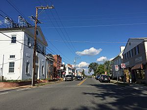
Main Street in Marshall
|
|
| Country | United States |
| State | Virginia |
| County | Fauquier |
| Area | |
| • Total | 2.89 sq mi (7.49 km2) |
| • Land | 2.88 sq mi (7.47 km2) |
| • Water | 0.008 sq mi (0.02 km2) |
| Elevation | 685 ft (209 m) |
| Population
(2010)
|
|
| • Total | 1,480 |
| • Density | 513/sq mi (198.1/km2) |
| Time zone | UTC−5 (Eastern (EST)) |
| • Summer (DST) | UTC−4 (EDT) |
| ZIP code |
20115
|
| FIPS code | 51-49656 |
| GNIS feature ID | 1495902 |
Marshall is a small community located in the northwestern part of Fauquier County, Virginia. It is called a census-designated place (CDP) because it is a populated area that the U.S. Census Bureau defines for statistics. In 2010, about 1,480 people lived there.
History of Marshall
Marshall was first known as "Salem." It later changed its name to Marshall. This happened after it was briefly set up as an official town, a process called incorporation. The town is named after John Marshall. He was a very important judge, known as the Chief Justice of the U.S. Supreme Court. John Marshall grew up nearby at a place called Oak Hill.
Marshall is home to the Fauquier Heritage and Preservation Foundation. This group works to protect the history of the area. You can also find the Number 18 School in Marshall here. This school was the last one-room school in Fauquier County. A one-room school means all grades learned together in one classroom.
The Number 18 School was first for white students. Later, it became a school for Black students. It closed in the 1960s because of desegregation. This was when schools across the country stopped being separated by race. The school has been fixed up and now school groups often visit it to learn about its history.
Several historic places in Marshall are listed on the National Register of Historic Places. These include the Ashville Historic District, the Marshall Historic District, and the Morgantown Historic District. The Number 18 School and a place called Waveland are also on this list.
Geography and Location
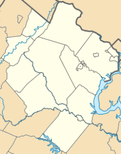
Marshall is located along State Route 55. It is between two exits of Interstate 66. If you travel east on I-66, it's about 50 miles (80 km) to Washington, D.C.. Going west on I-66, it's about 20 miles (32 km) to Front Royal, Virginia. U.S. Route 17 goes south from Marshall. It's about 12 miles (19 km) to Warrenton, which is the main town in Fauquier County.
The U.S. Census Bureau says Marshall covers about 2.9 square miles (7.5 km2) of land. Only a tiny part, about 0.01 square miles (0.02 km2), is water. Marshall sits on a low area where water flows in different directions. Water on the north and west sides flows towards Goose Creek. This creek eventually leads to the Potomac River. Water on the south side flows into Carter Run, which then goes to the Rappahannock River.
Marshall has always been a farming community. However, it is now also a "service district." This means it offers many businesses and professional services. These services are important for the surrounding area, especially for people involved in horse riding and farming.
See also
 In Spanish: Marshall (Virginia) para niños
 | Selma Burke |
 | Pauline Powell Burns |
 | Frederick J. Brown |
 | Robert Blackburn |


