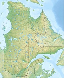
Martin-Valin Lake facts for kids
Quick facts for kids Martin-Valin Lake |
|
|---|---|
| Location | Mont-Valin |
| Coordinates | 48°39′07″N 70°47′14″W / 48.65194°N 70.78722°W |
| Primary inflows | Bras des Canots (coming upstream from Lac Moqueur) |
| Primary outflows | Bras des Canots |
| Basin countries | Canada |
| Max. length | 6.5 kilometres (4.0 mi) |
| Max. width | 0.5 kilometres (0.31 mi) |
| Surface elevation | 671 metres (2,201 ft) |
Lac Martin-Valin is a freshwater lake in the province of Quebec, Canada. It's located in the Mont-Valin area, which is a large unorganized territory. This lake is part of the Bras des Canots river system, which eventually flows into the St. Lawrence River.
The lake is found within the beautiful Monts-Valin National Park. This means the area is protected and great for outdoor activities. People often visit for fun and tourism, and forestry is also important here.
Many small forest roads lead to the lake's bays and surrounding areas. These roads help people get around for their outdoor adventures. The lake usually freezes over from late November to early April. It's generally safe to walk or play on the ice from mid-December to the end of March.
Contents
Exploring Lac Martin-Valin
Lac Martin-Valin is surrounded by many other lakes and rivers. Knowing these helps us understand where the lake fits into the larger water system.
Nearby Waterways
Here are some of the main water bodies close to Lac Martin-Valin:
- North: Moncouche Lake, Lake Poulin-De Courval, Laflamme Lake, Rivière aux Sables.
- East: Sainte-Marguerite River, Jalobert Lake (Mont-Valin), Olaf River, Lac aux Canots, Le Grand Ruisseau.
- South: Bras de l'Enfer, Valin River, Fournier Arm, Saguenay River.
- West: Bras des Canots, Lac aux Canots, Saint-Louis River, North Arm, La Mothe Lake, Shipshaw River.
Lake Features
Lac Martin-Valin is entirely within the forest, inside Monts-Valin National Park. The lake is about 6.5 kilometers (4 miles) long. Its widest point is about 0.5 kilometers (0.3 miles). The lake sits at an elevation of 671 meters (2,201 feet) above sea level.
The lake has a unique U-shape, curving towards the west. It also has ten islands and four bays along its southern shore. One bay on the north shore stretches about 0.3 kilometers (0.18 miles) south. Its length varies between 0.4 kilometers (0.25 miles) and 1.1 kilometers (0.68 miles).
Lake's Location and Flow
The water from Lac Martin-Valin flows out from its mouth. This mouth is located:
- About 2.6 kilometers (1.6 miles) southeast of Mont Le Valinouët (a mountain peak).
- About 7.9 kilometers (4.9 miles) northeast of Mont Victor-Tremblay.
- About 10.6 kilometers (6.6 miles) northeast of where the Bras des Canots joins the Valin River.
- About 25.7 kilometers (16 miles) northeast of where the Valin River joins the Saguenay River.
- About 33.2 kilometers (20.6 miles) northeast of downtown Saguenay.
From the lake's mouth, the water travels along the Bras des Canots for about 12.7 kilometers (7.9 miles). It flows southwest until it reaches the Valin River. From there, the water continues down the Valin River, then into the Saguenay River, and finally into the St. Lawrence River.
Name of the Lake
In the past, Lac Martin-Valin was known by a different name: "Second Canoe Lake." The official name, "Lac Martin-Valin," was formally recognized on February 12, 1987. This was done by the Commission de toponymie du Québec, which is the official body responsible for place names in Quebec.
More Information
Related Places and Rivers
- Bras des Canots: A stream that flows into and out of the lake.
- Valin River: A larger river that the Bras des Canots flows into.
- Saguenay River: An even larger river that the Valin River joins.
- Le Fjord-du-Saguenay Regional County Municipality: The local government area where the lake is located.
- Mont-Valin: The unorganized territory where the lake is found.
- Monts-Valin National Park: The protected park area that includes the lake.
- List of lakes of Saguenay–Lac-Saint-Jean: A list of other lakes in the region.
 | James Van Der Zee |
 | Alma Thomas |
 | Ellis Wilson |
 | Margaret Taylor-Burroughs |


