Massacre Peak facts for kids
Quick facts for kids Massacre Peak |
|
|---|---|
| Highest point | |
| Elevation | 5,667 ft (1,727 m) NGVD 29 |
| Geography | |
| Location | Luna County, New Mexico, U.S. |
| Parent range | Cookes Range |
| Topo map | USGS Massacre Peak |
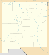
Massacre Peak is a mountain in Luna County, New Mexico. It stands tall at about 5,667 feet (1,727 meters) high. This peak is part of the Cookes Range.
History of Massacre Peak
This area was once a very important travel route. Old trails like the Southern Emigrant Trail passed just north of Massacre Peak. Other famous routes, such as the San Antonio–San Diego Mail Line and the Butterfield Overland Mail, also used this path. These were early stagecoach lines that helped people travel across the country.
The peak's name, Massacre Peak, comes from a difficult time in history. During the Apache Wars, there were many conflicts in this area. Travelers and stagecoach lines faced dangers, and many difficult events happened here. These events led to the peak getting its name. One notable conflict was the Battle of Cookes Canyon, which took place nearby.
Later, near the end of the American Civil War, a military post was built. Fort Cummings was set up about two miles (3.2 km) northeast of the peak. It was located close to Cooke's Spring, which was an important water source, and a stagecoach station.
 | Frances Mary Albrier |
 | Whitney Young |
 | Muhammad Ali |


