McArthur River facts for kids
Quick facts for kids McArthur |
|
|---|---|

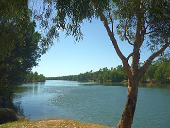
McArthur River at Borraloola, 2011
|
|
|
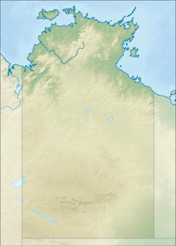
Location in Northern Territory, Australia
|
|
| Country | Australia |
| Territory | Northern Territory |
| Region | Katherine Region |
| Physical characteristics | |
| Main source | Barkly Tableland east of Elliott 234 m (768 ft) |
| River mouth | Gulf of Carpentaria east of Borroloola 0 m (0 ft) 15°54′S 136°40′E / 15.900°S 136.667°E |
| Length | 521 km (324 mi) |
| Depth |
|
| Basin features | |
| Basin size | 20,010 km2 (7,730 sq mi) |
The McArthur River is a river located in the Northern Territory of Australia. It flows into the Gulf of Carpentaria at a place called Port McArthur. This port is right across from the Sir Edward Pellew Group of Islands.
The river got its name from Ludwig Leichhardt, an explorer who mapped the area in 1845. He named it after James Macarthur and his family. The Macarthur family were big supporters of Leichhardt's journey. The McArthur River is very important to the local Aboriginal communities. They use it for fishing and other traditional activities.
Contents
What is the McArthur River like?
The area drained by the McArthur River, known as its basin, covers about 20,010 square kilometers (7,726 square miles). This basin is located between other river systems. To the north is the Rosie River, to the east is the Limmen Bight River, and to the west is the Robinson River. The Barkly River catchment is to the south.
The river's headwaters, where it begins, are on the northern edge of the Barkly Tableland. Each year, about 3,270,000 megaliters of water flow through the river. Some smaller rivers and creeks join the McArthur River. These include Tooganginie Creek, the Kilgour River, and the Clyde River.
The River's Estuary
The McArthur River has a long estuary that is affected by tides. This part of the river reaches inland all the way to the town of Borroloola. An estuary is where a river meets the sea, and the water is a mix of fresh and salt water.
This estuary is in very good condition. It is part of the Port McArthur Tidal Wetlands System. This area is also recognized as an Important Bird Area because many important bird species live there.
What happened with the McArthur River zinc mine?
The McArthur River zinc mine is one of the biggest zinc mines in the world. In 2007, there were plans to make the mine even bigger. However, these plans were stopped by a decision from the Supreme Court of the Northern Territory. The court found that the approval for the expansion, given by Mines Minister Chris Natt, was not valid.
Concerns of Traditional Owners
The traditional owners of the land were very worried about the mine expansion. The plan included changing the river's path by 5.5 kilometers (3.4 miles). They believed this would cause serious, long-lasting, and permanent damage to the river and its surroundings.
Court Decisions and Approval
In 2008, the case went to the Federal Court, which also ruled that the expansion was against the law. But in early 2009, the Federal Environment Minister, Peter Garrett, officially approved the mine's expansion.
Minister Garrett added certain rules to the project. These rules were put in place to help reduce the harm to animals like the freshwater sawfish and to birds that migrate through the area.
See also
- List of rivers of the Northern Territory
 In Spanish: Río McArthur para niños
 | Lonnie Johnson |
 | Granville Woods |
 | Lewis Howard Latimer |
 | James West |


