McClelland, Iowa facts for kids
Quick facts for kids
McClelland, Iowa
|
|
|---|---|

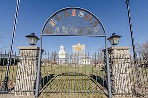
Ellison Gardens in McClelland, Iowa
|
|

Location of McClelland, Iowa
|
|
| Country | |
| State | |
| County | Pottawattamie |
| Township | Hardin |
| Area | |
| • Total | 0.27 sq mi (0.71 km2) |
| • Land | 0.27 sq mi (0.71 km2) |
| • Water | 0.00 sq mi (0.00 km2) |
| Elevation | 1,247 ft (380 m) |
| Population
(2020)
|
|
| • Total | 146 |
| • Density | 534.80/sq mi (206.27/km2) |
| Time zone | UTC-6 (Central (CST)) |
| • Summer (DST) | UTC-5 (CDT) |
| ZIP code |
51548
|
| Area code(s) | 712 |
| FIPS code | 19-47865 |
| GNIS feature ID | 2395060 |
McClelland is a small city located in Pottawattamie County, Iowa, in the United States. It was founded in 1903. This happened after the Great Western Railroad extended its tracks. The new rail line helped connect the area to Council Bluffs. In 2020, the city had a population of 146 people.
Contents
Geography of McClelland
McClelland is a small city in terms of its size. According to the United States Census Bureau, the city covers a total area of about 0.17 square miles (0.71 square kilometers). All of this area is land, meaning there are no large bodies of water within the city limits.
Population and People in McClelland
Understanding the population of a city helps us learn about its growth. A census is like a big count of all the people living in a place. It happens every ten years.
| Historical populations | ||
|---|---|---|
| Year | Pop. | ±% |
| 1910 | 134 | — |
| 1920 | 142 | +6.0% |
| 1930 | 161 | +13.4% |
| 1940 | 165 | +2.5% |
| 1950 | 159 | −3.6% |
| 1960 | 150 | −5.7% |
| 1970 | 146 | −2.7% |
| 1980 | 177 | +21.2% |
| 1990 | 139 | −21.5% |
| 2000 | 129 | −7.2% |
| 2010 | 151 | +17.1% |
| 2020 | 146 | −3.3% |
| Source: and Iowa Data Center Source: |
||
McClelland's 2020 Population Count
The most recent count was the 2020 census. It showed that 146 people lived in McClelland. These people lived in 54 different households. Most of these households, 44 of them, were families.
The city had about 534 people per square mile. Most residents, about 98.6%, identified as White. A small number of people were Asian or from other backgrounds. About 0.7% of the population identified as Hispanic or Latino.
The average age of people in McClelland was 45.5 years.
- About 23.3% of residents were under 20 years old.
- About 35.6% were between 45 and 64 years old.
- About 15.8% were 65 years or older.
The population was almost evenly split between males (50.0%) and females (50.0%).
McClelland's 2010 Population Count
The census in 2010 recorded 151 people living in McClelland. There were 54 households at that time. Most of these households, 45, were families.
The population density was about 888 people per square mile. Most of the people (94.0%) were White. A small percentage were African American or from two or more races. About 2.0% of the population was Hispanic or Latino.
The median age in 2010 was 36.5 years.
- About 28.5% of residents were under 18 years old.
- About 28.4% were between 25 and 44 years old.
- About 28.5% were between 45 and 64 years old.
The city's population was 45.7% male and 54.3% female in 2010.
Education in McClelland
Students living in McClelland attend schools within the Underwood Community School District. This district provides education for the children in the area.
See also
 In Spanish: McClelland (Iowa) para niños
 | Selma Burke |
 | Pauline Powell Burns |
 | Frederick J. Brown |
 | Robert Blackburn |


