
McCroskey State Park facts for kids
Quick facts for kids McCroskey State Park |
|
|---|---|
|
IUCN Category V (Protected Landscape/Seascape)
|
|

The park's scenic Skyline Drive in 2007,
much of it built by Virgil T. McCroskey himself |
|

McCroskey State Park
Location in Idaho

McCroskey State Park
Location in the United States
|
|
| Location | Benewah County & Latah County, Idaho, United States |
| Nearest city | Tensed |
| Area | 5,300 acres (21 km2) |
| Elevation | 4,022 ft (1,226 m) |
| Max. elevation | 4,324 ft (1,318 m) |
| Min. elevation | 3,039 ft (926 m) |
| Designation | Idaho state park |
| Established | 1955 |
| Named for | Mary Minerva McCroskey |
| Administrator | Idaho Department of Parks and Recreation |
| Website | McCroskey State Park |
McCroskey State Park—officially Mary Minerva McCroskey State Park—is a fun outdoor area in northern Idaho, USA. It's located in a beautiful region called the Palouse. This park covers about 5,300 acres (that's over 8 square miles!) and stretches along a ridge. It sits right on the border between Idaho and Washington.
Contents
The Park's Story
How McCroskey Park Began
McCroskey State Park was given to the state of Idaho in 1955. A local person named Virgil T. McCroskey (1876–1970) donated the land. He was a conservationist, which means he cared about protecting nature.
Virgil McCroskey slowly bought land that was in danger of being cut down by logging companies. He put all his purchases together to create a large area of about 4,400 acres. To make the land nice for visitors, he cleared spots for great views. He also built picnic areas, planted flowers, and created a road.
A Special Deal for the Park
The state government of Idaho wasn't sure about accepting the park at first. They worried it wouldn't make enough money to cover the taxes they would lose. So, they agreed to take the park only if McCroskey would take care of it himself for the next fifteen years.
Virgil McCroskey was in his late seventies at the time. But he agreed to these terms! He lived exactly fifteen more years, fulfilling his promise to Idaho just weeks before he passed away in 1970 at age 93.
Why the Park Has Its Name
McCroskey named the park to honor his mother, Mary. She was a pioneer woman who traveled from Tennessee with her family. They came to eastern Washington to start a farm.
Mary passed away when Virgil was only 14 years old. He dedicated the park to her and to all pioneer women. After Virgil McCroskey's death, the park didn't get much attention from the state for nearly twenty years. But things improved for the park in the late 1980s.
Exploring McCroskey State Park
Nature and Views
McCroskey State Park is located on the rocky slopes of Skyline Ridge. This area is a mix of different landscapes. To the west, you'll find the open Palouse prairie. To the east, you'll see the start of the Rocky Mountains.
The main attraction in the park is a narrow, unpaved road called Skyline Drive. This road winds for about 18 miles along a steep ridge. As you drive, you'll go through thick cedar forests. Then, you'll see tall ponderosa pine trees. Finally, the trees give way to open prairie.
Things to Do and See
Along Skyline Drive, you'll find signs that explain the area's history and nature. There are also many spots where you can stop and enjoy amazing views.
The park also has about 32 miles of trails. These trails are great for:
- Hiking
- Mountain biking
- Horseback riding
- Riding all-terrain vehicles (ATVs)
You can find picnic areas, simple restrooms (pit toilets), and basic campsites. There's also one place to get drinking water near the middle of Skyline Drive.
Wildlife and Park Access
Because the park is large and quiet, it's a great home for many animals. You might see deer, moose, and even black bears! It's important to know that even though it's a "park," some logging still happens within its boundaries.
The park is about 10 miles north of Potlatch. The easiest way to get there is from Highway 95. You can also enter the park from Farmington Road on the west side. This entrance is a few miles north of Farmington, Washington. On the Farmington side, you'll mostly just see the Skyline Drive sign, and the roads can be quite rough.
Gallery
-
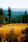
Looking south from Skyline Drive
-
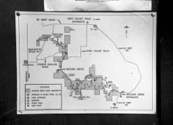
Map of McCroskey State Park
-
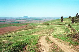
Skyline Drive with Steptoe Butte in background
-
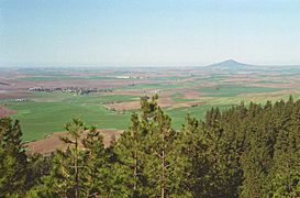
view of Farmington, WA and Steptoe Butte
-
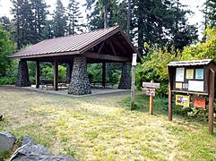
Covered Shelter at the Fireplace Day Use Area
-
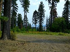
Scenic view from Fireplace Day Use Area


