
McFarland, California facts for kids
Quick facts for kids
McFarland, California
|
|
|---|---|

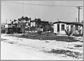
McFarland in 1940
|
|

Location in Kern County and the state of California
|
|

McFarland, California
Location in the United States
|
|
| Country | |
| State | |
| County | Kern |
| Founded | 1909 |
| Incorporated | July 18, 1957 |
| Named for | James Boyd McFarland |
| Area | |
| • Total | 2.67 sq mi (6.91 km2) |
| • Land | 2.67 sq mi (6.91 km2) |
| • Water | 0.00 sq mi (0.00 km2) 0% |
| Elevation | 354 ft (108 m) |
| Population
(2020)
|
|
| • Total | 14,161 |
| • Density | 6,476.86/sq mi (2,500.69/km2) |
| Time zone | UTC-8 (PST) |
| • Summer (DST) | UTC-7 (PDT) |
| ZIP code |
93250
|
| Area code(s) | 661 |
| FIPS code | 06-44826 |
| GNIS feature IDs | 1652750, 2411062 |
McFarland is a city in the San Joaquin Valley in Kern County, California. It was once known as Hunt and Lone Pine. McFarland is about 25 miles (40 km) north of Bakersfield and 6.5 miles (10.5 km) south of Delano. It sits at an elevation of 354 feet (108 meters). In 2020, about 14,161 people lived there.
Contents
McFarland's Story: A City's History
McFarland was founded by James Boyd McFarland. He was an educator who moved to California in the early 1900s. He wanted to work in real estate and grow walnuts.
How McFarland Began
In 1907, James Boyd McFarland visited Kern County. He was very impressed by how well crops could grow near a small community called Hunt's Siding. This community was home to about 50 families. They mostly farmed and raised livestock.
With help from a businessman named William Laird, McFarland bought 50 acres of land. This land is where the city of McFarland stands today. The first post office opened in 1908. The town was officially founded in 1909.
Growth and Changes Over Time
McFarland grew a lot during the Great Depression in the 1930s. However, its population became smaller during World War II. In the 1950s, a major highway, U.S. Route 99, was built. This highway divided the town into an east side and a west side.
McFarland officially became a city in the summer of 1957. The city was named after its founder, J.B. McFarland. In 2009, the city started its own police force again. Before that, the Kern County Sheriff's office had handled policing for many years.
McFarland USA: A True Story on Screen
In 2015, a movie called McFarland USA was released. This film is based on a true story from McFarland High School. The movie shows the school's cross country team and their coach, James White. Actor Kevin Costner played Coach White. The real cross country team went on to win nine state championships.
People of McFarland: Demographics
The population of McFarland has grown steadily over the years. It first appeared in the U.S. Census as an unincorporated community in 1950. Then, it was listed as a city in the 1960 Census.
| Historical population | |||
|---|---|---|---|
| Census | Pop. | %± | |
| 1950 | 2,183 | — | |
| 1960 | 3,686 | 68.9% | |
| 1970 | 4,177 | 13.3% | |
| 1980 | 5,151 | 23.3% | |
| 1990 | 7,005 | 36.0% | |
| 2000 | 9,618 | 37.3% | |
| 2010 | 12,707 | 32.1% | |
| 2020 | 14,161 | 11.4% | |
| U.S. Decennial Census | |||
McFarland's Population in 2010
According to the 2010 census, McFarland had 12,707 people. Most of the population, about 90.4%, lived in homes. A smaller number lived in group housing or institutions.
The city's population was made up of different groups. About 42.8% were White, 1.9% African American, and 1.3% Native American. About 49.8% were from other races. A large part of the population, 91.5%, identified as Hispanic or Latino.
There were 2,599 households in McFarland. Many households, about 69.9%, had children under 18 living there. The average household had about 4.42 people. The average family size was 4.51 people.
The median age in McFarland was 25.7 years. This means half the people were younger than 25.7, and half were older. About 35.2% of the population was under 18 years old.
Community Life in McFarland
McFarland has several places for recreation and learning. These include local parks and schools.
Parks for Fun and Play
McFarland has multiple parks where people can relax and play.
- Arturo J. Munoz Park
- Ritchey Park
- McFarland Park
- Browning Road Park
- Blanco Park
Schools for Learning
The city is home to several schools for students of all ages.
- Kern Avenue Elementary School
- Browning Road Elementary School
- McFarland Middle School
- McFarland High School
- San Joaquin High School (continuation)
- McFarland Independent School
- Horizon Elementary
Places of Worship
McFarland also has many churches and places of worship for its residents.
- Sherwood Avenue Baptist Church
- Saint Elizabeth Catholic Church
- El Buen Pastor Church
- Iglesia Ni Cristo
- Jehovah's Witnesses 124
- Church of the Living Savior
- Church of Jesus Christ of Latter-day Saints
- Mcfarland Apostolic Assembly
- CrossPointe Baptist Church McFarland
Images for kids
-
McFarland in 1940
See also
 In Spanish: McFarland (California) para niños
