
McIntosh, Alabama facts for kids
Quick facts for kids
McIntosh, Alabama
|
|
|---|---|
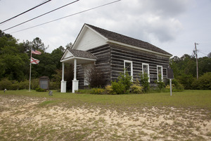
Andrews Chapel in McIntosh
|
|

Location of McIntosh in Washington County, Alabama.
|
|
| Country | United States |
| State | Alabama |
| County | Washington |
| Area | |
| • Total | 1.00 sq mi (2.58 km2) |
| • Land | 1.00 sq mi (2.58 km2) |
| • Water | 0.00 sq mi (0.00 km2) |
| Elevation | 49 ft (15 m) |
| Population
(2020)
|
|
| • Total | 206 |
| • Density | 206.83/sq mi (79.85/km2) |
| Time zone | UTC-6 (Central Time (CT)) |
| • Summer (DST) | UTC-5 (CDT) |
| ZIP code |
36553
|
| Area code(s) | 251 |
| FIPS code | 01-45472 |
| GNIS feature ID | 0152280 |
McIntosh, originally known as McIntosh Bluff, is a small town in Washington County, Alabama, United States. It is located along U.S. Route 43. The town is about 12.5 miles (20 km) south of Wagarville and 44 miles (71 km) north of Mobile. In 2020, 206 people lived there.
McIntosh is special because many of its residents are Native Americans. More than half of the people living in McIntosh reported being of Native American background in the 2020 census. Many residents are part of the MOWA Band of Choctaw Indians. This is a tribe recognized by the state of Alabama. They speak a language from the Muskogean family. The town also has one important historical building, Andrews Chapel, which is listed on the National Register of Historic Places.
Contents
History of McIntosh
McIntosh got its name from Captain John McIntosh. He was an officer in the British Army. Captain McIntosh had a special place where boats could land on the Tombigbee River. This spot was called McIntosh Bluff. The town of McIntosh officially became a town on April 7, 1970.
A famous event happened near McIntosh in 1807. A man named Aaron Burr was arrested there. At that time, this area was part of the Mississippi Territory. U.S. Army Lieutenant Edmund P. Gaines captured Burr in a nearby town called Wakefield. Burr was then held at Fort Stoddert. Today, there is a historical marker that tells about this event.
Geography of McIntosh
McIntosh is located in the southern part of Alabama. Its exact location is 31°15'58" North and 88°1'53" West. According to the U.S. Census Bureau, the town covers an area of 1.0 square mile (2.58 square kilometers). All of this area is land, with no water.
Population Information
| Historical population | |||
|---|---|---|---|
| Census | Pop. | %± | |
| 1970 | 297 | — | |
| 1980 | 319 | 7.4% | |
| 1990 | 250 | −21.6% | |
| 2000 | 244 | −2.4% | |
| 2010 | 238 | −2.5% | |
| 2020 | 206 | −13.4% | |
| U.S. Decennial Census 2013 Estimate |
|||
In 2000, there were 244 people living in McIntosh. There were 94 households and 62 families. The population density was about 244 people per square mile (94 people per square kilometer).
Most people in McIntosh are Native American, making up about 55% of the population. About 43% are Black or African American. A small number of people are White or from two or more races. Less than 1% of the population was Hispanic or Latino.
About 36% of households had children under 18 living with them. The average household had 2.60 people, and the average family had 3.27 people. The population was spread out by age. About 29.5% were under 18 years old. About 14.3% were 65 years or older. The average age in the town was 35 years.
Famous People from McIntosh
- George Troup: He was a U.S. Senator for Georgia and also served as the governor of Georgia.
- Brok Weaver: He is a mixed martial artist.
- Greg Wells: He used to play Major League Baseball.
See also
 In Spanish: McIntosh (Alabama) para niños
