
Washington County, Alabama facts for kids
Quick facts for kids
Washington County
|
||
|---|---|---|

The Washington County Courthouse in September 2007
|
||
|
||

Location within the U.S. state of Alabama
|
||
 Alabama's location within the U.S. |
||
| Country | ||
| State | ||
| Founded | June 4, 1801 | |
| Named for | George Washington | |
| Seat | Chatom | |
| Largest town | Chatom | |
| Area | ||
| • Total | 1,089 sq mi (2,820 km2) | |
| • Land | 1,080 sq mi (2,800 km2) | |
| • Water | 8.4 sq mi (22 km2) 0.8% | |
| Population
(2020)
|
||
| • Total | 15,388 | |
| • Estimate
(2023)
|
15,022 |
|
| • Density | 14.130/sq mi (5.4558/km2) | |
| Time zone | UTC−6 (Central) | |
| • Summer (DST) | UTC−5 (CDT) | |
| Congressional district | 1st | |
|
||

Washington County is a county in the southwestern part of Alabama. In 2020, about 15,388 people lived there. The main town, or county seat, is Chatom. The county is named after George Washington, who was the first President of the United States.
The MOWA Band of Choctaw Indians is a Native American tribe that is officially recognized by the state of Alabama. This tribe is based in Washington County. Some members also live in Mobile County, Alabama. Since 1979, nine tribes have been recognized by the state.
Contents
Exploring Washington County's Past
The land that is now Washington County was home to many Native American groups for a very long time. When Europeans first arrived, they met the Choctaw and later the Creek Indians. These tribes lived on the land before settlers from Europe moved in.
How Washington County Began
Washington County was created on June 4, 1800. It was formed from the Tombigbee District of the Mississippi Territory. This makes it the very first county organized in what would later become Alabama! Settlers were moving west after the American Revolutionary War. St. Stephens, located in Washington County, was even the first capital of the Alabama Territory.
In 1807, Aaron Burr, a former U.S. Vice President, was arrested in Washington County. He was accused of treason but was later found innocent.
Native American History and Changes
In the 1830s, the U.S. government moved most Choctaw and Creek people to Indian Territory (now Oklahoma). This was part of a process called Indian removal. However, some members of these tribes stayed behind. They hid in the forests and swamps of southwest Alabama. Even though they were citizens, they faced a lot of unfair treatment.
Farms, Slavery, and the Civil War
During the 1800s, many large cotton farms, called plantations, were built in the county. Thousands of enslaved African Americans were forced to work on these farms. They were brought to the Deep South by slave traders.
During the American Civil War, many white men from the county joined the Confederate Army. By 1863, over three-quarters of the adult white men were fighting. Children in the county even asked the government not to draft more men. They wanted men to stay and protect against a possible slave uprising. However, no such uprising happened.
Life After the Civil War
Even after the Civil War, farming was still very important. But a tiny insect called the boll weevil destroyed many cotton crops. New machines also meant fewer workers were needed on farms. Because of this, thousands of African Americans moved north. This movement is known as the Great Migration. They looked for better jobs and to escape unfair laws and violence in the South.
In the early 1900s, people started to cut down and process the many pine trees in the area. This became an important industry.
Recognizing Native American Culture
Native Americans in Alabama worked hard to keep their traditions alive. For a long time, the state only recognized people as white or "all other people of color." This made it hard for Native Americans to be seen as Choctaw.
In the 1930s, the Choctaw people finally got schools that supported their culture. These schools were in Mobile and Washington counties. In 1979, the Alabama government officially recognized the MOWA Band of Choctaw Indians. Later, a commission was set up to help Native American interests. Now, nine tribes have state recognition.
Modern Industries and Challenges
The timber industry is still important today. But Washington County has also developed other businesses. Petrochemical industries, which deal with oil and gas products, have grown. In 1979, Hurricane Frederic caused a lot of damage, and the county was declared a disaster area.
Washington County's Landscape
Washington County covers about 1,089 square miles. Most of this (1,080 square miles) is land, and a small part (8.4 square miles) is water. It's actually bigger than the state of Rhode Island in terms of land area! The county is about 60 miles north of the Gulf of Mexico. A huge amount of the land, about 88 percent, is covered by forests and pine tree farms.
The Tombigbee River forms the eastern border of Washington County. The county's borders also connect with the state of Mississippi to the west.
Neighboring Counties
Washington County shares its borders with these counties:
- Choctaw County (north)
- Clarke County (east)
- Baldwin County (southeast)
- Mobile County (south)
- Greene County, Mississippi (southwest)
- Wayne County, Mississippi (northwest)
Getting Around Washington County
Main Roads
 U.S. Highway 43
 U.S. Highway 45
 State Route 17
 State Route 56
Railroad Connections
The Norfolk Southern Railroad runs through the eastern part of Washington County. It carries raw materials from the Port of Mobile to chemical and electrical plants along the Tombigbee River.
People of Washington County
| Historical population | |||
|---|---|---|---|
| Census | Pop. | %± | |
| 1800 | 1,250 | — | |
| 1810 | 2,920 | 133.6% | |
| 1820 | 4,118 | 41.0% | |
| 1830 | 3,474 | −15.6% | |
| 1840 | 5,300 | 52.6% | |
| 1850 | 2,713 | −48.8% | |
| 1860 | 4,669 | 72.1% | |
| 1870 | 3,912 | −16.2% | |
| 1880 | 4,538 | 16.0% | |
| 1890 | 7,935 | 74.9% | |
| 1900 | 11,134 | 40.3% | |
| 1910 | 14,454 | 29.8% | |
| 1920 | 14,279 | −1.2% | |
| 1930 | 16,365 | 14.6% | |
| 1940 | 16,188 | −1.1% | |
| 1950 | 15,612 | −3.6% | |
| 1960 | 15,372 | −1.5% | |
| 1970 | 16,241 | 5.7% | |
| 1980 | 16,821 | 3.6% | |
| 1990 | 16,694 | −0.8% | |
| 2000 | 18,097 | 8.4% | |
| 2010 | 17,581 | −2.9% | |
| 2020 | 15,388 | −12.5% | |
| 2023 (est.) | 15,022 | −14.6% | |
| U.S. Decennial Census 1790–1960 1900–1990 1990–2000 2010–2020 |
|||
In 2020, there were 15,388 people living in Washington County. The population is made up of different groups. About 66.7% of people were White, 21.6% were Black or African American, and 7.2% were Native American. A small percentage were Asian, Pacific Islander, or other races. About 3.4% were of mixed race.
Population Changes Over Time
Like many rural areas, Washington County has seen its population decrease since 2000. This is because younger people often move to bigger cities for more job opportunities. Cities usually offer more services and better-paying jobs, which attracts people from rural areas.
Learning in Washington County
The Washington County School system runs the public schools. Here are some of the high schools:
- Fruitdale High School
- Leroy High School
- McIntosh High School
- Millry High School
- Washington County High School
Towns and Communities
Main Towns
Other Communities
- Calvert (partly in Mobile County)
- Cullomburg (partly in Choctaw County)
- Deer Park
- Fairford
- Fruitdale
- Hobson
- Leroy
- Malcolm
- St. Stephens
- Sims Chapel
- Tibbie
- Vinegar Bend
Small Villages and Areas
- Cortelyou
- Escatawpa
- Frankville
- Laton Hill
- Sunflower
- Wagarville
- Yellow Pine
- Yarbo
Historic Places
- Wakefield (a former town)
Places to Visit
Washington County has several interesting places listed on the National Register of Historic Places. These are important sites that are protected for their history:
- Andrews Chapel in McIntosh
- Old Washington County Courthouse
- Old St. Stephens Site in St. Stephens
You can also visit the Washington County Museum, which is located in the courthouse in Chatom.
Famous People from Washington County
- Wilmer Mizell (1930–1999) was born in Vinegar Bend. He was a professional baseball pitcher. After his sports career, he became a Republican congressman for North Carolina.
- Beverly Jo Scott, a singer-songwriter who now lives in Belgium, was born in Deer Park in 1959.
- Shawna Thompson, a singer in the country music duo Thompson Square, is from Chatom.
Images for kids
-
The flag of Washington County, Alabama
-
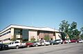
The Washington County Courthouse in September 2007
-
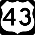
U.S. Highway 43 sign
-
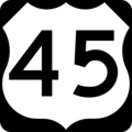
U.S. Highway 45 sign
-
Alabama State Route 17 sign
-
Alabama State Route 56 sign


See also
 In Spanish: Condado de Washington (Alabama) para niños
