Tombigbee District facts for kids
The Tombigbee District was an important area in what is now the state of Alabama. It was one of the first places in West Florida where British settlers from the Thirteen Colonies and other places made their homes. The other main area was the Natchez District.
Later, these areas became part of the Mississippi Territory in the United States. The Tombigbee District was also the first part of Alabama opened for white settlement, besides the French town of Mobile on the coast. When the Mississippi Territory was formed in 1798, the Tombigbee and Natchez districts were the only places with many white settlers.
The Tombigbee District was mostly on the west side of the Tombigbee River in Alabama. British colonists first settled here after the Treaty of Mobile in 1765. This treaty was signed between the British government of West Florida and the Choctaw people. The British had gained this land from France in 1763 through the Treaty of Paris. This happened after the British won the Seven Years' War against France.
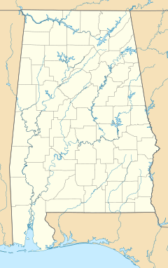
The district's borders were mainly close to the Tombigbee River. They included parts of what are now southern Clarke County, northern Mobile County, and most of Washington County.
Contents
What is the History of the Tombigbee District?
The borders of the Tombigbee District were set by a treaty in 1765. This treaty described the area starting at Grosse Pointe on Mon Louis Island. It then went up the western coast of Mobile Bay and the Mobile River. It followed the river to where the Alabama and Tombigbee rivers meet.
The treaty also said that British settlers should not live north of a certain creek on the Tombigbee River. This creek was called Centebonck (now Santa Bogue Creek).
When Did People Settle in the Tombigbee District?
Even though the 1765 treaty covered a large area, most of it was not settled right away. Some parts had already been settled by the French. Many years passed before more people moved to the Tombigbee River area.
Significant settlement began around the time of the American Revolution. People known as Loyalists started arriving. They were trying to escape problems from the Patriots. One of the first Loyalists was Thomas Bassett. He arrived in 1772 and received land grants from the British King. He was later killed in an attack by Native Americans in 1780.
Who Controlled the Tombigbee District?
The British controlled West Florida until 1779–81. During the American Revolutionary War, Spanish forces led by Bernardo de Gálvez captured it. West Florida officially became a Spanish territory with the Treaty of Paris in 1783. This treaty also ended the American Revolution.
This caused a disagreement over borders between the United States and Spain. The U.S. said the border was at the 31st parallel north. Spain claimed it was further north. Spain held the Tombigbee settlements until the Pinckney's Treaty in 1795. In this treaty, Spain agreed to the 31st parallel north as the border.
The U.S. Senate approved the treaty in 1796, and Spain approved it later that year. The treaty said that both countries would work together to mark the border. President George Washington chose Andrew Ellicott to lead this effort. The survey was finished in early 1800. However, American settlers had already started moving into the area in large numbers.
What Challenges Did Settlers Face?
Settlers in the Tombigbee District often faced attacks from Native Americans. These groups resisted people moving onto their land. In 1800, the Tombigbee District had about 1,250 people, including both free people and enslaved people. The main town in the district was St. Stephens. The Spanish had started this town by building Fort San Esteban in 1789.
On June 4, 1800, the Tombigbee District became the main part of the new Washington County, Mississippi Territory. Washington County was very large, stretching about 300 miles (480 km) east to west. It was later divided into many counties in both Mississippi and Alabama.
Even with the large size of Washington County, the Tombigbee District remained the main area where people lived. There were still tensions between American settlers and the Spanish in the Mobile District. Also, there was a constant threat of attacks from hostile Muscogee tribes.
The United States built Fort Stoddert in 1799. This was to stop its own citizens from attacking the Spanish. Before the War of 1812 and the Creek War, the Spanish in Mobile allowed British merchants to sell weapons to Native Americans. This was done to bother the American settlers in the Tombigbee District.
Using this as a reason, the United States took over the Mobile District in 1812. The city of Mobile remained under Spanish control for a short time. Then, General James Wilkinson led American troops from New Orleans to capture Mobile in April 1813.
 | Calvin Brent |
 | Walter T. Bailey |
 | Martha Cassell Thompson |
 | Alberta Jeannette Cassell |


