Natchez District facts for kids
The Natchez District was an important area in what is now the United States. It was one of two main regions set up by Great Britain in its West Florida colony during the 1770s. The district was located east of the Mississippi River, stretching from Bayou Sara (near modern-day St. Francisville, Louisiana) in the south to Bayou Pierre (near modern-day Port Gibson, Mississippi) in the north.
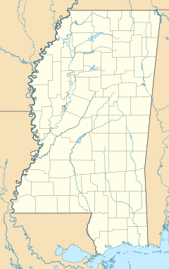
This area became very wealthy before the American Civil War (a period called "antebellum"). It was a major center for trading enslaved people and cotton. It was also the heart of cotton farming in the Old Southwest. Today, this region mostly covers the southwest part of Mississippi, south of Interstate 20 and west of Interstate 55.
After the United States bought a lot of land west of the Mississippi River in 1803 (the Louisiana Purchase), the low-lying area on the west side of the river was also seen as part of the Natchez District. Several areas there became large cotton farms. These included parts of Carroll, Concordia, Madison, and Tensas in Louisiana.
Contents
History of the Natchez District
Early Beginnings and Native Peoples
Before Europeans arrived, the Natchez District was home to the Natchez people and other Native American groups. European explorers, mainly French, knew about this area for many years.
In 1699, the French explorer Pierre Le Moyne d'Iberville traveled through the region. He named the Amité and the Tangipahoa rivers. In the early 1700s, settlers from French Louisiana began to bring enslaved Africans to the area. They also started large farms called plantations. The first important crop grown on these farms was tobacco.
British Control and Growth
In 1774, Great Britain made its West Florida colony bigger. This colony was created in 1763 after the French and Indian War. Its new border stretched further north. By 1776, many English-speaking farmers had settled there.
The land closest to the Mississippi River was developed first. This was because the river provided important transportation. Later, as a river port and market for cotton and enslaved people, Natchez became the richest area in the antebellum South.
Changing Hands: Spain and the U.S.
After the American Revolutionary War, Great Britain gave West Florida to Spain in 1783. However, the exact borders were not clear. Both Spain and the United States claimed control of the region. This led to a disagreement known as the West Florida Controversy.
In 1784, the Spanish closed New Orleans and the Mississippi River to American goods. This made it hard for American farmers to sell their crops. After several years of talks, Spain and the United States signed a treaty in 1795. This agreement, called Pinckney's Treaty, set the border between the U.S. and Spanish Florida. It also gave the U.S. the right to use the Mississippi River and to transfer goods in New Orleans without extra fees.
In 1796, the U.S. officially took control of the region. Then, in 1798, the United States Congress created the Mississippi Territory. This territory included both the Natchez and Tombigbee districts. Natchez became its first capital.
The Cotton Boom and Its Impact
How Cotton Changed the Region
The invention of the cotton gin by Eli Whitney in the late 1700s greatly changed the Natchez District and the entire Deep South. The cotton gin made it easy to process short-staple cotton, which grew well in the upland areas. Farmers in the Natchez District became very rich by switching from tobacco to cotton. There was a huge demand for cotton between 1785 and 1800.
The rich soil in the area was perfect for growing cotton. Farmers developed new, better types of cotton. They also improved cotton gins and created a large farming system that relied on both machines and a huge number of enslaved people.
Forced Migration and Wealth
This farming model spread across the South. It created such a high demand for enslaved people that over one million were forcibly moved from the Upper South. They were brought by land, riverboat, and ocean ships to New Orleans. This forced migration broke up families and brought a large new population of African descent to the area. The Deep South became a strong center of African-American culture.
Many cotton farmers became so wealthy that they owned thousands of acres of land and hundreds of enslaved African Americans to work it. They built fancy mansions in and around Natchez. They also hired overseers to manage their large farms in the countryside. For example, Stephen Duncan was said to own more than 1,000 enslaved people. This made him one of the richest cotton farmers in the world at that time.
New Cotton Varieties and Expansion
In 1806, an improved type of cotton from Mexico made the crop even more profitable. This Mexican cotton was mixed with older types to create new, better varieties that made Mississippi famous. Some well-known cotton types like Belle Creole and Petit Gulf were developed in Mississippi.
The cotton boom of the early 1800s spread from two main areas: coastal South Carolina and the Natchez District. Cotton farms grew all over the Southeast. From Natchez, the cotton farming system spread north into the Mississippi River valley and west along the rivers of Louisiana, Arkansas, and Texas. Before the Civil War, almost all plantations were built along a river for easy transportation.
The U.S. government quickly saw how important Natchez was. As the city grew into a major cotton port, Congress paid to build and improve roads leading to it. The U.S. Army made the Natchez Trace wider so that wagons could use it. This road connected the region to Nashville, Tennessee. It was put under the care of the Postmaster General of the United States, making it one of the earliest national highways.
 | Kyle Baker |
 | Joseph Yoakum |
 | Laura Wheeler Waring |
 | Henry Ossawa Tanner |


