
Baldwin County, Alabama facts for kids
Quick facts for kids
Baldwin County
|
||
|---|---|---|

The Baldwin County Courthouse in Bay Minette
|
||
|
||

Location within the U.S. state of Alabama
|
||
 Alabama's location within the U.S. |
||
| Country | ||
| State | ||
| Founded | December 21, 1809 | |
| Named for | Abraham Baldwin | |
| Seat | Bay Minette | |
| Largest city | Daphne | |
| Area | ||
| • Total | 2,027 sq mi (5,250 km2) | |
| • Land | 1,590 sq mi (4,100 km2) | |
| • Water | 437 sq mi (1,130 km2) 21.6% | |
| Population
(2020)
|
||
| • Total | 231,767 | |
| • Estimate
(2023)
|
253,507 |
|
| • Density | 114.340/sq mi (44.147/km2) | |
| Time zone | UTC−6 (Central) | |
| • Summer (DST) | UTC−5 (CDT) | |
| Congressional district | 1st | |
|
||

Baldwin County is a large area of land, also known as a county, located in the southwestern part of Alabama. It sits right on the Gulf Coast, which means it has beautiful beaches! Baldwin County is one of only two counties in Alabama that touch the Gulf of Mexico.
As of 2020, about 231,767 people lived here, making it the fourth-biggest county in Alabama by population. The main town where the county government is located is Bay Minette. The county is named after Abraham Baldwin, who helped start the University of Georgia.
Baldwin County grew very quickly between 2010 and 2020. It was the fastest-growing county in Alabama during that time! Many of its cities are also among the fastest-growing in the state. The U.S. government sees Baldwin County as a big connected area that includes the cities of Daphne, Fairhope, and Foley.
It's the largest county in Alabama when you look at its total area. It's located on the eastern side of Mobile Bay. A river called the Spanish River forms part of its western border with Mobile County. This river has a mix of fresh and saltwater.
Contents
History of Baldwin County
Baldwin County was officially created on December 21, 1809. This was ten years before Alabama even became a state! Before 1817, this area was part of the Mississippi Territory. Then, it became part of the separate Alabama Territory, and finally, Alabama became a state in 1819.
Over the years, the county's borders have changed as more people moved in and new counties were formed. Different armies have also been in the area during important wars like the Revolutionary War, the War of 1812, and the Civil War.
Changing County Seats
When Baldwin County first started, the town of McIntosh Bluff was its county seat. This town is now in Washington County. In 1820, the county seat moved to Blakeley. Then, in 1868, it moved again to Daphne.
But in 1900, the state decided the county seat should move to Bay Minette. The people in Daphne didn't want this to happen! So, the people of Bay Minette came up with a clever plan. They pretended a murder had happened to get the sheriff and his deputy to leave Daphne. While the law officers were busy looking for the fake killer, the Bay Minette group quietly traveled about 17 miles (27 km) to Daphne. They took all the important county records from the courthouse and brought them to Bay Minette! That's how Bay Minette became, and still is, the county seat of Baldwin County. A special painting from the 1930s, made during the Great Depression, shows this event. You can see it in the Bay Minette Post Office.
Life in the 1800s
During the American Civil War, some men from Baldwin County joined a Union army group in Florida. In 1860, Baldwin County had the fewest people of all 52 counties in Alabama. About half of the people living there were enslaved. There was also a large group of Muscogee (Creek) people, a Native American tribe, living in the northern part of the county.
Facing Hurricanes
Because it's so close to the Gulf of Mexico, Baldwin County often experiences strong storms called hurricanes. Since the late 1900s, the county has been declared a disaster area many times because of damage from hurricanes. Some of the big ones include Hurricane Frederic (1979), Hurricane Danny (1997), Hurricane Georges (1998), Hurricane Ivan (2004), Hurricane Katrina (2005), and Hurricane Sally (2020).
Geography of Baldwin County

Baldwin County is very large! It covers about 2,027 square miles (5,250 km²). About 1,590 square miles (4,118 km²) of this is land, and 437 square miles (1,132 km²) is water. This means about 21.6% of the county is water. It's the biggest county in Alabama by area, and it's even larger than the entire state of Rhode Island!
Neighboring Counties
Baldwin County shares its borders with several other counties:
- Monroe County - to the northeast
- Escambia County, Florida - to the east
- Escambia County, Alabama - to the east
- Mobile County - to the west
- Washington County - to the northwest
- Clarke County - to the northwest
Different Areas of the County
Baldwin County is often divided into different regions:
- North Baldwin
- Eastern Shore
- Central Baldwin
- South Baldwin
- Southwest Baldwin
- East Baldwin
Special Waterways
Two areas in Baldwin County have been named "Outstanding Alabama Water." This is the highest environmental award in the state! Part of Wolf Bay and 42 miles (68 km) of the Tensaw River in northern Baldwin County have received this special recognition. These areas have very clean water and are becoming popular places for eco-tourism, where people visit to enjoy nature.
Protected Natural Areas
Part of the Bon Secour National Wildlife Refuge is located in Baldwin County. This refuge helps protect wildlife and their natural homes.
Getting Around Baldwin County
Main Roads
Many important highways run through Baldwin County, making it easy to travel:
 Interstate 10
 Interstate 65
 U.S. Highway 31
 U.S. Highway 90
 U.S. Highway 98
 State Route 59
 State Route 104
 State Route 180
 State Route 181
 State Route 182
 State Route 225
 State Route 287
 Baldwin Beach Express
Airports
Baldwin County has several airports for smaller planes:
- Bay Minette Airport (1R8)
- Fairhope Airport (KCQF)
- Foley Airport (5R4)
- Stockton, Hubbard Landing Seaplane Base (HL2) for seaplanes
- Gulf Shores, Jack Edwards Airport (JKA)
For bigger commercial flights, people usually use Mobile Regional Airport, Mobile Downtown Airport, or Pensacola International Airport.
Population of Baldwin County
| Historical population | |||
|---|---|---|---|
| Census | Pop. | %± | |
| 1810 | 1,427 | — | |
| 1820 | 1,713 | 20.0% | |
| 1830 | 2,324 | 35.7% | |
| 1840 | 2,951 | 27.0% | |
| 1850 | 4,414 | 49.6% | |
| 1860 | 7,530 | 70.6% | |
| 1870 | 6,004 | −20.3% | |
| 1880 | 8,603 | 43.3% | |
| 1890 | 8,941 | 3.9% | |
| 1900 | 13,194 | 47.6% | |
| 1910 | 18,178 | 37.8% | |
| 1920 | 20,730 | 14.0% | |
| 1930 | 28,289 | 36.5% | |
| 1940 | 32,324 | 14.3% | |
| 1950 | 40,997 | 26.8% | |
| 1960 | 49,088 | 19.7% | |
| 1970 | 59,382 | 21.0% | |
| 1980 | 78,556 | 32.3% | |
| 1990 | 98,280 | 25.1% | |
| 2000 | 140,415 | 42.9% | |
| 2010 | 182,265 | 29.8% | |
| 2020 | 231,767 | 27.2% | |
| 2023 (est.) | 253,507 | 39.1% | |
| U.S. Decennial Census 1790–1960 1900–1990 1990–2000 2010–2020 |
|||
As of the 2020 census, there were 231,767 people living in Baldwin County. This included 93,116 households and 64,222 families. The county is home to people from many different backgrounds. In 2020, about 80% of the people were White, 7.7% were Black or African American, and about 5.4% were Hispanic or Latino. Many other groups also live and contribute to the community.
The population has grown a lot over the years. In 2010, there were 182,265 people, and by 2020, it had increased significantly. The average age in the county in 2010 was about 41 years old.
Education in Baldwin County
Baldwin County has many schools for kids from kindergarten through 12th grade. About 32,500 students attend public schools here. For a long time, there was just one big school district for the whole county. However, some cities have started their own school systems.
For example, the city of Gulf Shores created its own school system in 2017. More recently, in 2022, the city of Orange Beach also decided to have its own school system.
There are also private Catholic elementary schools in the county, like Christ the King in Daphne and St. Patrick in Robertsdale. In 2016, a Catholic high school, St. Michael Catholic High School, opened near Fairhope.
For higher education, Coastal Alabama Community College has several campuses in Baldwin County. Also, the United States Sports Academy, a private university focused on sports, is located in Daphne.
School Districts
The public schools in Baldwin County are managed by these districts:
- Baldwin County School District
- Gulf Shores City School District
- Orange Beach City School District
Communities in Baldwin County
Baldwin County has many different towns and cities, each with its own unique feel.
Cities
- Bay Minette (This is where the county government is!)
- Daphne
- Fairhope
- Foley
- Gulf Shores
- Loxley
- Orange Beach
- Robertsdale
- Spanish Fort
Towns
Census-Designated Places
These are areas that are like towns but don't have their own local government:
Other Areas (Unincorporated)
These are smaller communities that are not part of any city or town:
- Barnwell
- Battles Wharf
- Belforest
- Blacksher
- Bromley
- Carpenter's Station
- Clay City
- Crossroads
- Elsanor
- Fort Morgan
- Gasque
- Gateswood
- Hurricane
- Josephine
- Latham
- Little River
- Malbis
- Marlow
- Miflin
- Montrose
- Oak
- Ono Island
- Oyster Bay
- Pine Grove
- Rabun
- Seacliff
- Seminole
- Tensaw
Old Towns (Ghost Towns)
Some towns that used to exist in Baldwin County are now "ghost towns," meaning they are no longer populated:
- Belle Fontaine
- Blakeley
Images for kids
-
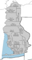
Old maps showing how Baldwin County was divided for the census from 1930 to 1950.
-
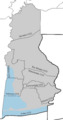
Current maps showing how Baldwin County is divided for the census as of 2020.
See also
 In Spanish: Condado de Baldwin (Alabama) para niños
