
Escambia County, Alabama facts for kids
Quick facts for kids
Escambia County
|
||
|---|---|---|

Escambia County, Alabama Courthouse
|
||
|
||

Location within the U.S. state of Alabama
|
||
 Alabama's location within the U.S. |
||
| Country | ||
| State | ||
| Founded | December 10, 1868 | |
| Seat | Brewton | |
| Largest city | Atmore | |
| Area | ||
| • Total | 953 sq mi (2,470 km2) | |
| • Land | 945 sq mi (2,450 km2) | |
| • Water | 8.1 sq mi (21 km2) 0.8% | |
| Population
(2020)
|
||
| • Total | 36,757 | |
| • Estimate
(2023)
|
36,558 |
|
| • Density | 38.570/sq mi (14.892/km2) | |
| Time zone | UTC−6 (Central) | |
| • Summer (DST) | UTC−5 (CDT) | |
| Congressional districts | 1st, 2nd | |
|
||

Escambia County is a county in the south-central part of Alabama. In 2020, about 36,757 people lived here. Its main town, or county seat, is Brewton. The largest city is Atmore.
Escambia County is home to the Poarch Band of Creek Indians. This is Alabama's only Native American tribe officially recognized by the U.S. government. They have built businesses, including hotels and resorts, on their land. These businesses help support the tribe.
Contents
What Does "Escambia" Mean?
The name "Escambia" might come from the Creek word Shambia. This word means "clearwater." It could also come from a Choctaw word for a place with lots of tall reeds or canes.
A Look Back in Time
Early History and Native Americans
For hundreds of years, different Native American tribes lived in this area. These included the Creek, Choctaw, and Alabama tribes. They had many settlements here. In the early 1800s, many of these tribes were forced to give up their lands. They had to move far away, west of the Mississippi River.
Founding the County
Escambia County was created after the American Civil War. This happened on December 10, 1868. It was formed from parts of Baldwin and Conecuh counties. For a long time, farming was the main activity in the county.
Facing Hurricanes
This county is on the coast, so it can get strong winds and heavy rains from hurricanes. In 1979, Hurricane Frederic caused a lot of damage. The county was declared a disaster area. In 2004, Hurricane Ivan also caused major damage, and it was again declared a disaster area.
The Poarch Creek Indians Today
In the 1900s, the Poarch Band of Creek Indians worked hard to be recognized as a tribe. They created their own government. The U.S. government officially recognized them. This helped them get land set aside for their tribe. Since then, they have built businesses to help their community.
Alabama also recognizes nine other tribes. These are mostly descendants of the Choctaw, Creek, and Cherokee people.
Where is Escambia County?
Escambia County covers about 953 square miles. Most of this is land, with a small amount of water.
Main Roads
You can travel through Escambia County on several important roads:
 Interstate 65
 U.S. Highway 29
 U.S. Highway 31
 State Route 21
 State Route 41
 State Route 113
Neighboring Counties
Escambia County shares borders with these counties:
- Conecuh County (north)
- Covington County (east)
- Okaloosa County, Florida (southeast)
- Santa Rosa County, Florida (south)
- Escambia County, Florida (southwest)
- Baldwin County (west)
- Monroe County (northwest)
It's interesting that Escambia County in Alabama and Escambia County in Florida are next to each other! This is rare in the United States.
Protected Areas
Part of the Conecuh National Forest is located in Escambia County. This is a protected natural area.
Who Lives in Escambia County?
| Historical population | |||
|---|---|---|---|
| Census | Pop. | %± | |
| 1870 | 4,041 | — | |
| 1880 | 5,719 | 41.5% | |
| 1890 | 8,666 | 51.5% | |
| 1900 | 11,320 | 30.6% | |
| 1910 | 18,889 | 66.9% | |
| 1920 | 22,464 | 18.9% | |
| 1930 | 27,963 | 24.5% | |
| 1940 | 30,671 | 9.7% | |
| 1950 | 31,443 | 2.5% | |
| 1960 | 33,511 | 6.6% | |
| 1970 | 34,912 | 4.2% | |
| 1980 | 38,440 | 10.1% | |
| 1990 | 35,518 | −7.6% | |
| 2000 | 38,440 | 8.2% | |
| 2010 | 38,319 | −0.3% | |
| 2020 | 36,757 | −4.1% | |
| 2023 (est.) | 36,558 | −4.6% | |
| U.S. Decennial Census 1790–1960 1900–1990 1990–2000 2010–2020 |
|||
In 2020, the population of Escambia County was 36,757 people. There were about 13,089 households.
Population Makeup
Based on the 2020 census, here's a general idea of the population:
- About 59.86% of people were White.
- About 29.71% were Black or African American.
- About 4.05% were Native American.
- About 3.84% were of two or more races.
- About 2.04% were Hispanic or Latino (who can be of any race).
In 2012, the largest ancestry groups people reported were English, "American," and Irish.
Towns and Communities
Cities
- Atmore
- Brewton (This is the county seat!)
- East Brewton
Towns
Smaller Communities
- Canoe
- Dixonville
- Foshee
- Freemanville
- Huxford
- McCullough
- Nokomis
- Spring Hill
- Wahl
Native American Reservation
Schools in the County
There are two main school districts in Escambia County. The Brewton City School District serves the city of Brewton. The Escambia County School District covers all other areas.
Historic Places to Visit
Escambia County has three places listed on the National Register of Historic Places. These are special places recognized for their history. They include the Atmore Commercial Historic District, the Brewton Historic Commercial District, and the Commercial Hotel-Hart Hotel.
Famous People from Escambia County
- Esther McGowin Blake (1897–1979) was the first woman to join the United States Air Force.
Images for kids
-
Seal of Escambia County, Alabama
-
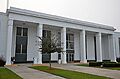
Escambia County, Alabama Courthouse
See also
 In Spanish: Condado de Escambia (Alabama) para niños
