McKnight Mountain facts for kids
Quick facts for kids McKnight Mountain |
|
|---|---|
| Highest point | |
| Elevation | 10,165 ft (3,098 m) |
| Prominence | 2,525 ft (770 m) |
| Geography | |
| Location | Sierra / Grant counties, New Mexico, U.S. |
| Parent range | Black Range |
| Topo map | USGS Victorio Park |
| Climbing | |
| Easiest route | Trail hike |
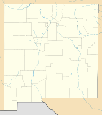
McKnight Mountain is a really tall mountain in New Mexico, in the southwestern United States. It's the highest point in the Black Range mountains. You can find it about 30 miles (48 km) northeast of Silver City. This mountain is part of the beautiful Aldo Leopold Wilderness within the Gila National Forest.
About McKnight Mountain
This mountain stands super tall at 10,165 feet (3,098 meters) high! Its very top isn't pointy like some mountains. Instead, it has a flat ridge that stretches for about half a mile. Both the north and south ends of this ridge reach the same amazing height.
The mountain is covered with trees almost all the way to its top. The very summit is rocky, but it offers incredible views all around. You can see far across the landscape from up there!
Where the Water Flows
Water from McKnight Mountain flows in different directions. The west side of the mountain is where the East Fork of the Mimbres River begins. This river flows through a place called McKnight Canyon. Water from the northwest slopes also joins the Mimbres River.
On the east side, water drains into Las Animas Creek. This creek eventually flows into the Rio Grande at Caballo Lake. You might know about the Continental Divide. It's like an imaginary line that separates which ocean rainwater will flow to. While the Continental Divide runs along much of the Black Range, McKnight Mountain itself is not directly on it. The divide separates from the main mountain range a few miles north at Red Peak.
How to Explore McKnight Mountain
You can reach McKnight Mountain by hiking on several trails. One popular path is Trail 79. This trail follows the top of the Black Range. You can start this trail about 5 miles (8 km) south of the mountain. The trailhead is near McKnight Cabin, at the end of Forest Road 152.
Another way to get to the peak is by taking Trail 82. This trail comes from the west side, going through McKnight Canyon. Hiking these trails lets you experience the beauty of the wilderness and reach the top of this amazing mountain.
 | Lonnie Johnson |
 | Granville Woods |
 | Lewis Howard Latimer |
 | James West |


