Meall an Fhudair facts for kids
Quick facts for kids Meall an Fhudair |
|
|---|---|

Meall an Fhudair
|
|
| Highest point | |
| Elevation | 764 m (2,507 ft) |
| Prominence | 382 m (1,253 ft) |
| Listing | Corbett, Marilyn |
| Geography | |
| Location | Argyll and Bute, Scotland |
| Parent range | Grampian Mountains |
| OS grid | NN270192 |
| Topo map | OS Landranger 50, 56 |
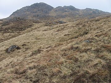
Meall an Fhudair is a mountain in the beautiful Grampian Mountains of Scotland. It stands 764 meters (about 2,507 feet) tall. This makes it a significant peak in the area.
The mountain is located just north of the famous Arrochar Alps. It is also quite close to the small village of Inverarnan. Meall an Fhudair is known for being a wild and spread-out mountain. It offers amazing views from its top.
Contents
Exploring Meall an Fhudair
Meall an Fhudair is a popular spot for hikers and nature lovers. Many people start their walks from the main A82 road. This road is located just to the east of the mountain.
What to Expect on a Hike
Hiking up Meall an Fhudair can be an exciting adventure. The paths might be a bit wild, but the effort is worth it. As you climb higher, you'll see more and more of the stunning Scottish landscape.
Views from the Summit
Once you reach the top, the views are incredible. You can see across the Grampian Mountains. On a clear day, you might even spot distant lochs (lakes) and other peaks. It's a perfect place to take some memorable photos.
Mountain Classifications
Meall an Fhudair is special because it belongs to two important lists of Scottish mountains. These lists help people understand a mountain's size and features.
What is a Corbett?
A Corbett is a mountain in Scotland that is between 2,500 feet (762 meters) and 3,000 feet (914 meters) high. It must also have a "prominence" of at least 500 feet (152 meters). Prominence means how much a mountain rises above the land around it. Meall an Fhudair fits this description perfectly.
What is a Marilyn?
A Marilyn is a hill or mountain of any height in the British Isles. The main rule for a Marilyn is that it must have a prominence of at least 150 meters (492 feet). This means it stands out clearly from the surrounding land. Meall an Fhudair is also a Marilyn.
Geography of the Area
Meall an Fhudair is part of the Grampian Mountains. This is one of the three main mountain ranges in Scotland. The Grampians cover a large area of the Scottish Highlands.
Nearby Locations
The mountain is in Argyll and Bute, a region on the west coast of Scotland. This area is famous for its beautiful lochs, islands, and rugged landscapes. The nearby village of Inverarnan is a small community. It is often a starting point for exploring the local mountains.
 | Jessica Watkins |
 | Robert Henry Lawrence Jr. |
 | Mae Jemison |
 | Sian Proctor |
 | Guion Bluford |

