Medicine Butte facts for kids
Quick facts for kids Medicine Butte |
|
|---|---|

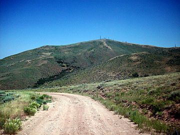
Medicine Butte, as seen from the south, looking north
|
|
| Highest point | |
| Elevation | 8,610 ft (2,620 m) |
| Geography | |
| Location | Uinta County, Wyoming |
| Parent range | Uinta Mountains |
| Climbing | |
| Easiest route | Access road |
Medicine Butte is a mountain located in Uinta County, Wyoming. It is about 11 kilometers (6.9 miles) north of the city of Evanston, Wyoming. The mountain stands 2,624 meters (8,610 feet) tall and has a road that leads to its top.
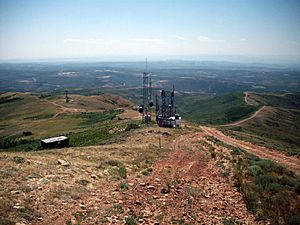
Native Americans gave the mountain its name because they found many different kinds of herbs and roots on its slopes. These plants were used for traditional medicine. Sometimes, the mountain is also called "Fremont’s Monument" after an explorer named John C. Fremont. Today, Medicine Butte is an important spot for many radio towers that help with communication in the area.
Contents
Radio Towers on Medicine Butte
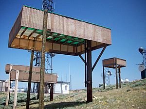
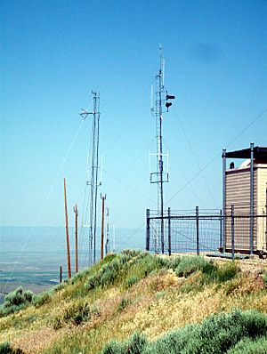
The top of Medicine Butte is home to many radio towers. These towers are used for different communication systems. Some of the most important ones are for powerful FM radio stations and smaller relay stations that send signals to nearby towns.
Here are some of the radio stations that have transmitters on Medicine Butte:
| Call Sign | Frequency | Type of Music/Talk |
|---|---|---|
| KUWE | 89.7 | Public Radio |
| K212GA | 90.3 | Religious |
| KPMD | 91.9 | Christian Contemporary |
| K237FD | 95.3 | Christian Contemporary |
| KADQ | 98.3 | Classic Rock |
| KNYN | 99.1 | Country |
Besides regular radio stations, Medicine Butte also has towers for amateur radio (also known as "ham radio"). These are used by radio enthusiasts to talk to people far away. Local companies and emergency services for Evanston and Uinta County also use towers on the mountain. Even the United States Forest Service has a tower there.
KNYN Radio Station
KNYN is one of the strongest radio stations broadcasting from Medicine Butte. In 2005, the station had some trouble when part of its tower collapsed. This happened because of heavy ice in the area. Since then, KNYN has been using a backup transmitter and broadcasting at a lower power.
Television Signals
Medicine Butte is also important for television. It helps bring TV signals from the Salt Lake City area to rural parts of Wyoming and Idaho. This means people in these areas can watch their favorite shows.
Here are some of the television stations that broadcast from Medicine Butte:
| Call Sign | Channel | Network |
|---|---|---|
| K16HW-D | 16 | KUED - PBS |
| K23DS-D | 23 | Wyoming Public Television |
| K27KV-D | 27 | The CW |
| K32DS | 32 | Wyoming Public Television |
How to Visit Medicine Butte
You can reach Medicine Butte by taking Red Willow Road. This road is located north of Evanston, just off US Highway 89. The road is also used to get to Evanston's landfill, but a branch turns off to go up the mountain. The road can be a bit rough in some spots, so it's a good idea to use a vehicle with four-wheel drive to get to the top.
 | Charles R. Drew |
 | Benjamin Banneker |
 | Jane C. Wright |
 | Roger Arliner Young |


