Melville Island (Northern Territory) facts for kids
|
Native name:
(Tiwi) Yermalner
|
|
|---|---|

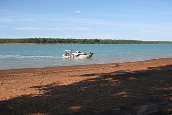
Melville Island, viewed from Bathurst Island
|
|

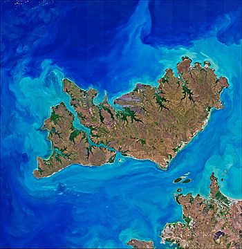
Satellite image of Melville Island (top right) with Bathurst Island (left) and the Australian mainland (bottom right)
|
|
| Geography | |
| Location | Timor Sea |
| Coordinates | 11°33′S 130°56′E / 11.550°S 130.933°E |
| Archipelago | Tiwi Islands |
| Major islands | Melville, Irrititu |
| Area | 5,786 km2 (2,234 sq mi) |
| Administration | |
|
Australia
|
|
| Territory | Northern Territory |
| Largest settlement | Milikapiti (pop. 559) |
| Demographics | |
| Population | c. 1030 |
| Ethnic groups | Tiwi |
Melville Island is a large island in the Timor Sea. It is located near the coast of the Northern Territory in Australia. The local Tiwi people call it Yermalner.
Melville Island is part of the Tiwi Islands group. This group also includes Bathurst Island and nine smaller islands. The Tiwi Islands are managed by the Northern Territory government. They work closely with the Tiwi Land Council.
Contents
History of Melville Island
People have lived on the land that is now the Tiwi Islands for a very long time. Indigenous people have been there for at least 40,000 years.
Early European Sightings and Naming
The first European to see the island was likely Abel Tasman in 1644. Later, explorer Phillip Parker King named the island. He named it after Robert Dundas, 2nd Viscount Melville. Dundas was an important leader in the British navy.
Fort Dundas Settlement
In 1824, the British tried to set up a settlement on Melville Island. This place was called Fort Dundas. It was the first attempt by the British to live on Australia's north coast. However, the settlement did not last long. It was abandoned in 1828.
Life on the Island
There was once a Catholic mission on Melville Island. This mission was a place where many children were raised. For example, the mother of famous Australian athlete Nova Peris grew up there.
During World War II, a small group called the Snake Bay Patrol was formed. Local Tiwi people were part of this patrol. Their job was to protect the island from possible attacks by Japanese forces.
Geography and Climate
Melville Island is located in the eastern Timor Sea. It is about 60 kilometers (37 miles) north of Darwin. It is also west of the Cobourg Peninsula in Arnhem Land.
Size of the Island
Melville Island covers an area of 5,786 square kilometers (2,234 square miles). This makes it the second-largest island in Australia. Only Tasmania is bigger. A smaller island called Irrititu Island is just south of Melville Island. It is about 1.60 square kilometers (0.62 square miles) in size.
Weather on the Island
The islands have a tropical climate. This means they are usually warm all year round. They also experience wet and dry seasons.
Population
The largest town on Melville Island is Milikapiti. About 559 people live there. The second-largest town is Pirlangimpi. It used to be called Garden Point. About 440 people live in Pirlangimpi. It is located 27 kilometers (17 miles) west of Milikapiti.
About 30 more people live in smaller family communities. These communities are called outstations.
Governance
Melville Island is part of the Tiwi Islands. The Northern Territory government has authority over the island. The Tiwi Land Council also plays a very important role. They work together to manage the land and its people.
See also
 In Spanish: Isla Melville (Australia) para niños
 | Jessica Watkins |
 | Robert Henry Lawrence Jr. |
 | Mae Jemison |
 | Sian Proctor |
 | Guion Bluford |

