Mercerville, New Jersey facts for kids
Quick facts for kids
Mercerville, New Jersey
|
|
|---|---|

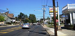
The Five Points intersection
|
|

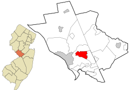
Location in Mercer County and the state of New Jersey
|
|
| Country | |
| State | |
| County | Mercer |
| Township | Hamilton |
| Area | |
| • Total | 3.72 sq mi (9.63 km2) |
| • Land | 3.69 sq mi (9.55 km2) |
| • Water | 0.03 sq mi (0.08 km2) 1.14% |
| Elevation | 98 ft (30 m) |
| Population
(2020)
|
|
| • Total | 13,447 |
| • Density | 3,646.1/sq mi (1,407.8/km2) |
| Time zone | UTC−05:00 (Eastern (EST)) |
| • Summer (DST) | UTC−04:00 (Eastern (EDT)) |
| ZIP Code |
08619
|
| FIPS code | 34-45480 |
| GNIS feature ID | 02389472 |
Mercerville is a community in New Jersey. It is located in Mercer County, within Hamilton Township. It is also known as a census-designated place (CDP), which means it's an area identified by the U.S. Census Bureau for statistical purposes.
In 2020, Mercerville had a population of 13,447 people. Before 2010, Mercerville was part of a larger CDP called Mercerville-Hamilton Square. It was then split into two separate CDPs: Mercerville and Hamilton Square.
Contents
History of Mercerville
Mercerville has many historical markers. These markers show the path of the Continental Army during the American Revolutionary War. George Washington led his troops through this area. Some markers show their night march from the Second Battle of Trenton to the Battle of Princeton.
Mercerville was first called "Sandtown." It was renamed after General Hugh Mercer. He was a hero who died on January 12, 1777, from injuries he got at the Battle of Princeton.
Nearby, Hamilton Square was also renamed. It used to be called Nottingham, like a town in Britain. But during the War of 1812, people felt less friendly towards Britain. So, it was renamed after Alexander Hamilton, a famous American leader.
Mercerville's Geography
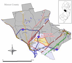
Mercerville is in the southern part of Mercer County. Its center is a big intersection called Five Points. Trenton, the state capital, is about 4 miles (6.4 km) to the west.
Five Points is where several important roads meet. These include Quaker Bridge Road, Edinburg Road, Nottingham Way, and White Horse-Mercerville Road. Most of Mercerville's businesses are found along these roads. Interstate 295 also runs through the western side of Mercerville.
The Mercerville CDP covers about 3.72 square miles (9.63 km²). Most of this area is land, with a small amount of water. The community's water flows into Miry Run and Pond Run. These streams eventually lead to the Delaware River.
Population Information
| Historical population | |||
|---|---|---|---|
| Census | Pop. | %± | |
| 2010 | 13,230 | — | |
| 2020 | 13,447 | 1.6% | |
| U.S. Decennial Census 2010 2020 |
|||
In 2010, Mercerville had 13,230 people living there. By 2020, the population had grown slightly to 13,447 people.
Education in Mercerville
Most high school students living in Mercerville attend Nottingham High School.
See also
 In Spanish: Mercerville para niños
 | Chris Smalls |
 | Fred Hampton |
 | Ralph Abernathy |


