Merritt, South Dakota facts for kids
Quick facts for kids
Merritt, South Dakota
|
|
|---|---|
| Country | United States |
| State | South Dakota |
| Counties | Lawrence and Pennington |
| Elevation | 5,105 ft (1,556 m) |
| Time zone | UTC-7 (MST) |
| • Summer (DST) | UTC-6 (MDT) |
Merritt is what people call a ghost town in South Dakota, United States. It's located in both Lawrence County and Pennington County. A ghost town is a place that used to be a busy community but is now mostly empty and abandoned.
Merritt: A South Dakota Ghost Town
What Was Merritt Like?
Merritt was once a small community focused on logging. This means people there cut down trees for wood. The town had important buildings like a school, a post office, and even a ranger station.
Merritt played a big role in helping nearby mining towns. It provided wood and fuel for the mines in places like Lead and Deadwood.
Over time, people moved away, and Merritt became abandoned. By the 1970s, almost nothing was left of the town. The only thing still there was a trout ranch, where fish were raised.
Where Was Merritt Located?
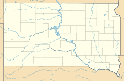
The old site of Merritt is in the Black Hills of South Dakota. It sits right on the border between Pennington and Lawrence Counties. You can find it on the west side of US 385.
Merritt was also at the southern end of the Black Hills & Fort Pierre Railroad. It was about 18 miles north of Hill City. The elevation of this old town site is about 5,105 feet (1,556 meters) above sea level.
 | Anna J. Cooper |
 | Mary McLeod Bethune |
 | Lillie Mae Bradford |


