Mertens, Texas facts for kids
Quick facts for kids
Mertens, Texas
|
|
|---|---|

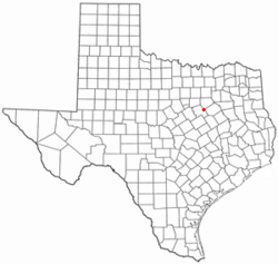
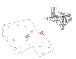
Location of Mertens, Texas
|
|
 |
|
| Country | United States |
| State | Texas |
| County | Hill |
| Area | |
| • Total | 0.44 sq mi (1.13 km2) |
| • Land | 0.43 sq mi (1.13 km2) |
| • Water | 0.00 sq mi (0.00 km2) |
| Elevation | 522 ft (159 m) |
| Population
(2020)
|
|
| • Total | 144 |
| • Density | 327/sq mi (127.4/km2) |
| Time zone | UTC-6 (Central (CST)) |
| • Summer (DST) | UTC-5 (CDT) |
| ZIP code |
76666
|
| Area code(s) | 903 |
| FIPS code | 48-47820 |
| GNIS feature ID | 2412987 |
Mertens is a small town located in Hill County, Texas, in the United States. It sits right along State Highway 22. In 2020, about 144 people called Mertens home.
Contents
Where is Mertens, Texas?
Mertens is found in the eastern part of Hill County. This area is often called Central Texas. Part of the town's eastern edge touches the Navarro County line.
If you travel on Highway 22, you'll find Hillsboro about 14 miles (23 km) to the west. Hillsboro is the main town, or county seat, of Hill County. Going east on the same highway, Corsicana is about 26 miles (42 km) away.
The United States Census Bureau says that Mertens covers a total area of about 0.44 square miles (1.1 square kilometers). Most of this area is land. Only a tiny bit, about 0.18%, is water.
How Mertens Began
The first people settled in the Mertens area in the late 1880s. This was a time when railroads were being built across the country. The St. Louis Southwestern Railway was constructed through this area. It connected Corsicana to Hillsboro.
The town got its name from the wife of the engineer on the very first train that passed through. In 1888, Mertens opened its own post office. Just four years later, a bank was established. At that time, the town had a population of just over 75 people.
Around the same time, the International–Great Northern Railroad also reached Mertens. This railway connected Italy to Malone. This meant Mertens became a special place where two important railway lines crossed. The town officially became a city in 1914. Electric power arrived in Mertens the very next year.
Who Lives in Mertens?
| Historical population | |||
|---|---|---|---|
| Census | Pop. | %± | |
| 1920 | 342 | — | |
| 1930 | 338 | −1.2% | |
| 1940 | 251 | −25.7% | |
| 1950 | 210 | −16.3% | |
| 1960 | 104 | −50.5% | |
| 1970 | 109 | 4.8% | |
| 1980 | 133 | 22.0% | |
| 1990 | 104 | −21.8% | |
| 2000 | 146 | 40.4% | |
| 2010 | 125 | −14.4% | |
| 2020 | 144 | 15.2% | |
| U.S. Decennial Census 2020 Census |
|||
The town's population has changed over the years. In 1920, there were 342 people living in Mertens. By 1960, the population had dropped to 104. In 2000, there were 146 people living in Mertens. The most recent count in 2020 showed 144 residents.
In 2000, most people in Mertens were White (84.25%). About 4.11% were Native American. About 10.96% were from other racial backgrounds. A small number (0.68%) identified with two or more races. About 17.81% of the population identified as Hispanic or Latino.
The average age of people in Mertens in 2000 was 40 years old. About 25.3% of the population was under 18 years old. About 19.9% were 65 years or older.
Education in Mertens
Students in Mertens attend schools that are part of the Frost Independent School District.
See also
 In Spanish: Mertens (Texas) para niños
 | Claudette Colvin |
 | Myrlie Evers-Williams |
 | Alberta Odell Jones |

