Mesa Arch facts for kids
Quick facts for kids Mesa Arch |
|
|---|---|

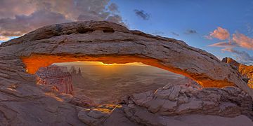
Mesa Arch, October 2009
|
|
| Highest point | |
| Elevation | 6,099 ft (1,859 m) |
| Geography | |
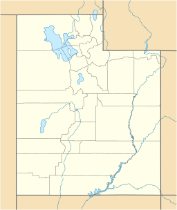
| Location | Canyonlands National Park San Juan County, Utah, U.S. |
| Topo map | USGS Musselman Arch |
| Type of rock | Navajo Sandstone |
Mesa Arch is a famous natural stone arch found in Canyonlands National Park in Utah, United States. It is also known by other names like Rotary Arch and Trail Arch. This amazing arch sits right on the edge of a tall cliff. From here, you can see huge canyons and distant mountains like the La Sal Mountains.
Mesa Arch is a type of pothole arch. It formed on the eastern side of a flat-topped mountain called the Island in the Sky mesa. The arch is made from Navajo Sandstone.
Visiting Mesa Arch
Getting to Mesa Arch is quite easy. There is a hiking trail that is only about half a mile long. This trail starts right from the main park road. Many people visit Mesa Arch, especially at sunrise. The sun rising through the arch creates a beautiful glow. This makes it a very popular spot for photographers.
Weather at Mesa Arch
The best times to visit Mesa Arch are during spring and fall. The weather is usually mild and pleasant then.
Mesa Arch is in a cold semi-arid climate zone. This means it's a desert area. The coldest month has an average temperature below 0°C (32°F). Most of the rain and snow falls during spring and summer.
This desert area gets less than 10 inches (250 mm) of rain each year. Snowfall in winter is usually light.
 | Chris Smalls |
 | Fred Hampton |
 | Ralph Abernathy |


