Meugher facts for kids
Quick facts for kids Meugher |
|
|---|---|

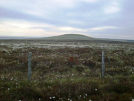
Meugher from the west
|
|
| Highest point | |
| Elevation | 575 m (1,886 ft) |
| Prominence | 36 m (118 ft) |
| Parent peak | Great Whernside |
| Listing | Dewey |
| Geography | |
| OS grid | SE 0440 7042 |
| Topo map | OS Landranger 98 |
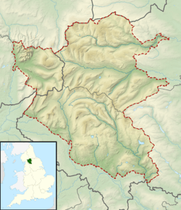
Meugher (pronounced like moo-fer) is a hill located in the beautiful Yorkshire Dales area of England. It's a bit hidden away, found between two valleys called Wharfedale and Nidderdale. Even though it's very close to the Yorkshire Dales National Park, it's actually part of the Nidderdale Area of Outstanding Natural Beauty.
Contents
About Meugher Hill
Meugher is known for its unique shape. It has a peak that looks a bit like a cone. At the very top, you'll find a special marker called a triangulation pillar. This pillar was put there by the Ordnance Survey to help mapmakers create accurate maps of the land.
Some people describe Meugher as one of the most remote and quiet hills in the Yorkshire Dales. This means it's not usually crowded with visitors.
Getting to the Top
There aren't any official public paths that go right to the summit of Meugher. However, thanks to a law passed in 2000 (the Countryside and Rights of Way Act 2000), the land around Meugher is now "open access land." This means people can walk there freely, even if there isn't a marked path.
You can reach the hill using a track that was made for shooting. This track starts near a village called Lofthouse. It gets you quite close to the top, about 430 meters (or 470 yards) away. Another way to get close is from a public footpath. This path is about a mile northwest of the summit and connects Middlesmoor to Conistone.
Water Around Meugher
Meugher is an important part of the Nidderdale area's water system. Different streams flow from the hill. Meugher Dyke drains the southern side, while Back Stean Gill flows from the eastern side. Cross Gill takes water from both the western and northern parts of the hill.
What Does the Name "Meugher" Mean?
The name Meugher was first written down as Magare way back in 1120. It likely comes from an old language called Old Norse. In Old Norse, mjór haugr meant "small hill." So, the name Meugher probably means "small hill."
 | Janet Taylor Pickett |
 | Synthia Saint James |
 | Howardena Pindell |
 | Faith Ringgold |


