Great Whernside facts for kids
Quick facts for kids Great Whernside |
|
|---|---|

Great Whernside from next to Tor Dyke near the road between Kettlewell and Coverdale
|
|
| Highest point | |
| Elevation | 704 m (2,310 ft) |
| Prominence | c. 288 m |
| Parent peak | Whernside |
| Listing | Marilyn, Hewitt, Nuttall |
| Geography | |
| OS grid | SE002739 |
| Topo map | OS Landranger 98 |
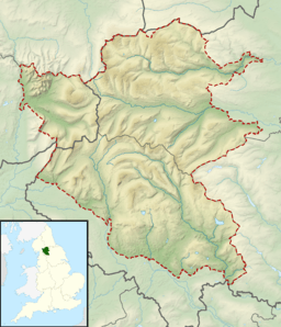
Great Whernside is a tall hill, also called a fell, located in the beautiful Yorkshire Dales in England. It's important not to confuse it with another hill called Whernside, which is about 27 kilometres (17 miles) to the west.
The very top of Great Whernside is the highest point on the eastern side of Wharfedale, looking down over the village of Kettlewell. This hill acts like a natural divider, separating the valleys of Wharfedale and Nidderdale. It also sits right on the edge of the Yorkshire Dales National Park and the Nidderdale Area of Outstanding Natural Beauty. The River Nidd actually starts its journey on the eastern slopes of Great Whernside, above Angram Reservoir.
What's in a Name?
The name Whernside means "hillside where millstones were found." A millstone is a large, round stone used to grind grain into flour. The top part of Great Whernside is made of a type of rock called millstone grit. Long ago, there were quarries on the side of the hill facing Wharfedale where these stones were dug out.
Some people believe the name was first used for just the hillside on the Wharfedale side. Later, it was used for the entire hill when seen from Wharfedale. The hill, when viewed from Nidderdale, used to be known as Blackfell. The word Great was added to the name in 1771. This was probably to help tell it apart from a smaller hill nearby called Little Whernside.
Getting to the Top
For a long time, there wasn't a clear public path to the top of Great Whernside. But in 1997, two public footpaths were officially created. One path goes from Kettlewell in Wharfedale directly to the summit. The other path runs along the very top ridge of the hill.
Thanks to a law passed in 2000, large parts of the fell are now "open access land." This means people can walk freely across them. You can climb Great Whernside from Kettlewell. There's also a shorter way from Park Rash Pass. This pass is on a smaller road that connects Kettlewell to Coverdale. Another, less common, route starts from Scar House Reservoir. If you try to climb from the east, be aware that the paths can be quite muddy, even after a long period of dry weather.
Around the Hill
Little Whernside is another hill located about 2.5 miles (4 kilometres) northeast of Great Whernside. It forms the natural boundary between Coverdale and Nidderdale.
Halfway between Kettlewell and the summit of Great Whernside, you'll find Hag Dyke. This is a special hostel run by the 1st Ben Rhydding Scout Group from Ilkley. It's a great place for scouts to stay while exploring the area.
The fell has also been the site of some aircraft incidents over the years.
Tor Dike is an interesting old earthwork found on the northwestern side of the hill. It's a structure made of earth with a ditch and a raised bank, built into the limestone. Experts think it might have been built by Iron Age tribes around the 1st century AD. They may have built it to protect themselves from the invading Romans. Another idea is that it was built much later, during the Dark Ages.
 | James B. Knighten |
 | Azellia White |
 | Willa Brown |


