Mifflinville, Pennsylvania facts for kids
Quick facts for kids
Mifflinville, Pennsylvania
|
|
|---|---|

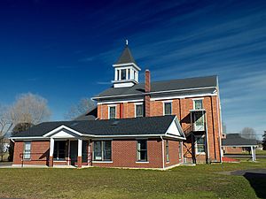
Mifflinville United Methodist Church
|
|

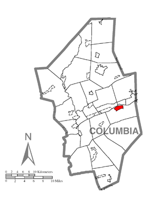
Location within Columbia County
|
|
| Country | United States |
| State | Pennsylvania |
| County | Columbia |
| Township | Mifflin |
| Area | |
| • Total | 1.38 sq mi (3.57 km2) |
| • Land | 1.37 sq mi (3.55 km2) |
| • Water | 0.01 sq mi (0.02 km2) |
| Elevation | 510 ft (160 m) |
| Population
(2020)
|
|
| • Total | 1,233 |
| • Density | 900.00/sq mi (347.50/km2) |
| Time zone | UTC-5 (Eastern (EST)) |
| • Summer (DST) | UTC-4 (EDT) |
| ZIP Code |
18631
|
| FIPS code | 42-49312 |
| GNIS feature ID | 1213288 |
Mifflinville is a small community located in Columbia County, Pennsylvania, in the United States. It is known as a census-designated place (CDP). This means it is an area that the government defines for gathering statistics, even though it is not an official city or town. In 2020, about 1,233 people lived there. Mifflinville is part of a larger region called Northeastern Pennsylvania. It is also part of the Bloomsburg-Berwick micropolitan area.
Geography

Mifflinville is located in the eastern part of Columbia County. It sits on the south side of the Susquehanna River, which is a very long river in Pennsylvania. The community is a few miles southwest of Berwick.
The total area of Mifflinville is about 1.38 square miles (3.57 square kilometers). Most of this area is land, with only a tiny bit being water. The eastern part of Mifflinville has many farmlands, while the western part is where most people live. The land in Mifflinville is mostly flat.
Interstate 80, a major highway, passes just southwest of Mifflinville. You can get to Mifflinville from Exit 242, which connects to Pennsylvania Route 339. From Mifflinville, you can travel east on PA 339 to Nescopeck. From there, it's a short distance north across the Susquehanna River to Berwick. Bloomsburg, which is the main town of Columbia County, is about 9 miles (14 km) to the west. You can reach Bloomsburg using either Interstate 80 or U.S. Route 11.
Population Information
| Historical population | |||
|---|---|---|---|
| Census | Pop. | %± | |
| 2020 | 1,233 | — | |
| U.S. Decennial Census | |||
In 2000, there were 1,213 people living in Mifflinville. The population density was about 876 people per square mile (338 people per square kilometer). There were 508 households in the area.
The population was spread out by age. About 21% of the people were under 18 years old. About 5.6% were between 18 and 24 years old. The largest groups were those aged 25 to 44 (27.9%) and 45 to 64 (28.4%). About 17.1% of the population was 65 years old or older. The average age in Mifflinville was 42 years.
Education
Mifflinville is part of the Central Columbia School District. For those looking to go to college, Bloomsburg University of Pennsylvania is the closest university to Mifflinville.
Interesting Facts
Did you know that the famous 2011 Rockefeller Center Christmas Tree came from Mifflinville? It was a very tall Norway spruce tree, standing 74 feet (23 meters) high!
See also
 In Spanish: Mifflinville para niños
 | Victor J. Glover |
 | Yvonne Cagle |
 | Jeanette Epps |
 | Bernard A. Harris Jr. |


