Milburn, Oklahoma facts for kids
Quick facts for kids
Milburn, Oklahoma
|
|
|---|---|

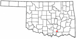
Location of Milburn, Oklahoma
|
|
| Country | United States |
| State | Oklahoma |
| County | Johnston |
| Area | |
| • Total | 0.47 sq mi (1.22 km2) |
| • Land | 0.47 sq mi (1.22 km2) |
| • Water | 0.00 sq mi (0.00 km2) |
| Elevation | 712 ft (217 m) |
| Population
(2020)
|
|
| • Total | 252 |
| • Density | 537.31/sq mi (207.33/km2) |
| Time zone | UTC-6 (Central (CST)) |
| • Summer (DST) | UTC-5 (CDT) |
| ZIP code |
73450
|
| Area code(s) | 580 |
| FIPS code | 40-48400 |
| GNIS feature ID | 2412993 |
Milburn is a small town in Johnston County, Oklahoma. It is located along the Blue River. In 2020, about 252 people lived there.
Milburn is famous for the Chickasaw White House. This was once the home of Douglas H. Johnston. He was a governor of the Chickasaw Nation. Today, the Chickasaw White House is a museum. It is also a protected historic place. It is listed on the National Register of Historic Places.
Milburn's Early History
A town called Ellen was started in 1856. It was part of the Chickasaw Nation. This was an area known as Indian Territory. Ellen was about 3 miles (4.8 km) from where Milburn is today.
Later, a railroad was being built. It was called the Western Oklahoma Railroad. A man named W. J. Milburn was a druggist. He convinced a Chickasaw landowner, M. C. Condon, to let him find a new town site. This new site would be closer to the railroad.
Mr. Milburn tried to get the post office from Ellen to move. He wanted them to rename the new town. He suggested the name Condon, but the Post Office said no. Many names were thought of for the new town. The railroad first wanted to name it Morris. Then they changed it to McLish. Finally, in August 1901, everyone agreed on the name Milburn.
By 1904, Milburn had enough people to become an official Chickasaw town. In 1907, Oklahoma became a state. An election was held to choose the new county seat for Johnston County. Milburn lost this election to the town of Tishomingo.
Where is Milburn Located?
Milburn is a small town with a total area of about 0.5 square miles (1.22 square kilometers). All of this area is land.
The town is found where State Highway 48A and State Highway 78 meet. It is about 8 miles (13 km) east of Tishomingo. Tishomingo is the main city in Johnston County.
Milburn's Population Changes
| Historical population | |||
|---|---|---|---|
| Census | Pop. | %± | |
| 1910 | 438 | — | |
| 1920 | 496 | 13.2% | |
| 1930 | 429 | −13.5% | |
| 1940 | 442 | 3.0% | |
| 1950 | 350 | −20.8% | |
| 1960 | 228 | −34.9% | |
| 1970 | 275 | 20.6% | |
| 1980 | 376 | 36.7% | |
| 1990 | 264 | −29.8% | |
| 2000 | 312 | 18.2% | |
| 2010 | 317 | 1.6% | |
| 2020 | 252 | −20.5% | |
| U.S. Decennial Census | |||
In the year 2000, there were 312 people living in Milburn. These people lived in 114 homes. About 84 of these were families. The town had about 654 people per square mile (252 per square kilometer). There were 124 housing units in total.
Most people in Milburn were White (88.78%). Some were Native American (6.73%). A small number were from other backgrounds. About 0.96% of the population was Hispanic or Latino.
About 33.3% of homes had children under 18 living there. Most homes (57.9%) were married couples. About 11.4% of homes had a female head without a husband. About 26.3% of homes were not families.
The average home had 2.74 people. The average family had 3.30 people.
The population was spread out by age. About 30.8% were under 18 years old. About 12.5% were 65 years or older. The average age was 36 years. For every 100 females, there were about 81 males.
The average income for a home in Milburn was $21,528. For families, it was $29,375. About 29.4% of all people lived below the poverty line. This included 29.3% of those under 18. It also included 36.0% of those 65 or older.
See also
 In Spanish: Milburn (Oklahoma) para niños
 | Lonnie Johnson |
 | Granville Woods |
 | Lewis Howard Latimer |
 | James West |

