
Miltonvale, Kansas facts for kids
Quick facts for kids
Miltonvale, Kansas
|
|
|---|---|

Location within Cloud County and Kansas
|
|

|
|
| Country | United States |
| State | Kansas |
| County | Cloud |
| Founded | 1881 |
| Incorporated | 1883 |
| Named for | Milton Tootle |
| Area | |
| • Total | 0.76 sq mi (1.97 km2) |
| • Land | 0.76 sq mi (1.97 km2) |
| • Water | 0.00 sq mi (0.00 km2) |
| Elevation | 1,401 ft (427 m) |
| Population
(2020)
|
|
| • Total | 440 |
| • Density | 579/sq mi (223.4/km2) |
| Time zone | UTC-6 (CST) |
| • Summer (DST) | UTC-5 (CDT) |
| ZIP code |
67466
|
| Area code | 785 |
| FIPS code | 20-46950 |
| GNIS ID | 2395337 |
Miltonvale is a small city located in Cloud County, Kansas, United States. In 2020, about 440 people lived there. It's a quiet place with a rich history.
Contents
Miltonvale's Story: A Look at Its History
Miltonvale was started on December 1, 1881. The town grew because a special kind of railway, called a narrow gauge railway, was built nearby. It was named after Milton Tootle, who owned land in the area.
In 1887, a big railroad company called Atchison, Topeka and Santa Fe Railway built a new line that passed through the area. Today, this railroad is known as the BNSF Railway, but many local people still call it the "Santa Fe."
From 1909 to 1972, Miltonvale was home to Miltonvale Wesleyan College. This college was an important part of the town for many years.
Miltonvale's Location and Climate
Miltonvale covers an area of about 0.76 square miles (1.97 square kilometers). All of this area is land, with no large bodies of water.
What's the Weather Like in Miltonvale?
The weather in Miltonvale has hot and humid summers. Winters are usually mild to cool. This type of weather is known as a humid subtropical climate.
Who Lives in Miltonvale?
| Historical population | |||
|---|---|---|---|
| Census | Pop. | %± | |
| 1890 | 591 | — | |
| 1900 | 396 | −33.0% | |
| 1910 | 829 | 109.3% | |
| 1920 | 821 | −1.0% | |
| 1930 | 814 | −0.9% | |
| 1940 | 800 | −1.7% | |
| 1950 | 911 | 13.9% | |
| 1960 | 814 | −10.6% | |
| 1970 | 718 | −11.8% | |
| 1980 | 588 | −18.1% | |
| 1990 | 484 | −17.7% | |
| 2000 | 523 | 8.1% | |
| 2010 | 539 | 3.1% | |
| 2020 | 440 | −18.4% | |
| U.S. Decennial Census | |||
Miltonvale's Population in 2020
In 2020, the 2020 United States census counted 440 people living in Miltonvale. There were 189 households, which are groups of people living together.
About 27.3% of the people in Miltonvale were under 18 years old. About 19.5% were 65 years old or older. The average age in the city was 41.3 years.
Miltonvale's Population in 2010
Back in 2010, the census showed that 539 people lived in Miltonvale. The average age was 36.8 years. About 29.7% of the people were under 18 years old, and 19.9% were 65 or older.
Learning and Sports in Miltonvale
The public schools in Miltonvale are part of the Southern Cloud USD 334 school district.
The Miltonvale Pirates, which is the local high school team, won the state championship for volleyball in 1978. This was a big achievement for the community!
As mentioned before, Miltonvale Wesleyan College was also located here from 1909 to 1972.
Famous People from Miltonvale
Some notable people have connections to Miltonvale:
- Jim Garlow, a well-known evangelical pastor.
- Nellie Tayloe Ross, who made history as the first woman governor in the United States. She was the governor of Wyoming.
- Patrice Wymore, an actress who appeared in vaudeville shows and movies. She was also the third wife of actor Errol Flynn.
Images for kids
-
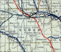
This map from 1915 shows the railroads in Cloud County.

See also
 In Spanish: Miltonvale para niños
