Mitchell Lake (Apica River) facts for kids
Quick facts for kids Mitchell Lake |
|
|---|---|
| Location | Lac-Jacques-Cartier |
| Coordinates | 47°52′05″N 71°23′55″W / 47.86805°N 71.39861°W |
| Lake type | Natural |
| Primary inflows | (from the mouth) Ruisseaux riverains, décharge (venant du sud-est) du lac Micoine et décharge (venant du sud) des lacs des Groseillers et de la Fourmillière. |
| Primary outflows | Apica River |
| Basin countries | Canada |
| Max. length | 5.5 km (3.4 mi) |
| Max. width | 0.5 km (0.31 mi) |
| Surface elevation | 752 m (2,467 ft) |
Mitchell Lake, also known as Lac Mitchell, is a beautiful freshwater lake in Quebec, Canada. It's part of a large water system that connects to the Apica River, the Pikauba River, and the Saguenay River. This lake is located in a special area called Lac-Jacques-Cartier. It's a popular spot for fun outdoor activities like vacations!
People mostly visit this area for recreation and tourism. Other important activities include farming and forestry.
The surface of Mitchell Lake usually freezes over from early December until the end of March. However, it's generally safe to walk or play on the ice from mid-December to mid-March.
Contents
Where is Mitchell Lake?
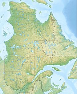
Mitchell Lake is located in the Capitale-Nationale region of Quebec. It's part of the La Côte-de-Beaupré Regional County Municipality.
The lake is about 5.5 km (3.4 mi) long and 0.5 km (0.31 mi) wide. It sits at an elevation of 752 m (2,467 ft) above sea level.
Water Sources for the Lake
Mitchell Lake gets its water from several places:
- Small streams along its banks.
- Water flowing out from Lake Micoine, which is to the southeast.
- Water flowing out from Groseillers Lake and La Fourmillière Lake, both to the south.
The lake also has a narrow part, like an arm, that stretches 0.9 km (0.56 mi) to the south. This forms a peninsula pointing north, which includes a mountain reaching 835 m (2,740 ft) high.
Nearby Waterways
The main rivers and streams near Mitchell Lake are:
- North side: Apica River, Pikauba River
- East side: Côté stream, Leboeuf stream, Pikauba River, Croche stream, Talbot Lake
- South side: Mignault Lake, Madeleine Creek, Rivière aux Écorces North-East
- West side: Rivière aux Canots, Oligny Lake, Jubinville Lake, Willie Creek
How the Water Flows from Mitchell Lake
The water from Mitchell Lake flows out from its northwest side. This water then travels a long way through several rivers and lakes before reaching the ocean.
Here's the path the water takes:
- First, it flows into the Apica River for about 14.0 km (8.7 mi).
- Then, it joins the Pikauba River and travels generally north for about 61.6 km (38.3 mi).
- Next, it crosses Kenogami Lake for 17.6 km (10.9 mi) towards the northeast.
- After Kenogami Lake, the water enters the Chicoutimi River and flows east, then northeast, for 26.2 km (16.3 mi).
- Finally, it reaches the Saguenay River and travels east for 114.6 km (71.2 mi) to Tadoussac. Here, the water merges with the Saint Lawrence estuary, which leads to the Atlantic Ocean!
Why is it Called Mitchell Lake?
The name "Mitchell" comes from a family name that is originally English. The name "Lac Mitchell" was officially recognized on December 5, 1968, by the Commission de toponymie du Québec. This commission is in charge of naming places in Quebec.
Related Places
- La Côte-de-Beaupré Regional County Municipality
- Lac-Jacques-Cartier, an unorganized territory
- Saguenay River
- Chicoutimi River
- Kenogami Lake
- Pikauba River
- Apica River
- List of lakes in Canada
 | Misty Copeland |
 | Raven Wilkinson |
 | Debra Austin |
 | Aesha Ash |


