Mitchell Lake (Ontario) facts for kids
Quick facts for kids Mitchell Lake |
|
|---|---|

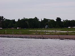
Photo showing the two areas of the lake, separated by the Hartley Road causeway
|
|
| Location | Kawartha Lakes, Ontario |
| Coordinates | 44°34′26″N 78°57′01″W / 44.57389°N 78.95028°W |
| Type | Lake |
| Part of | Great Lakes Basin |
| Primary inflows | Trent–Severn Waterway, Grass Creek |
| Primary outflows | Trent–Severn Waterway, Grass Creek |
| Basin countries | Canada |
| Max. length | 3.3 kilometres (2.1 mi) |
| Max. width | 2.2 kilometres (1.4 mi) |
| Surface elevation | 256 metres (840 ft) |
Mitchell Lake is a small, man-made lake in Ontario, Canada. It is part of the huge Great Lakes Basin system. You can find this lake in the city of Kawartha Lakes.
Mitchell Lake was created around the early 1900s. This happened when the Kirkfield Lift Lock was being built. The lock was finished and working by the end of 1907. The lake is a key part of the Trent–Severn Waterway. This waterway connects Balsam Lake to Lake Simcoe. Eventually, boats can travel from Lake Ontario to Lake Huron using this system.
How Mitchell Lake Was Formed
Before Mitchell Lake existed, the area was mostly marshland. A river called the Grass River flowed through it. This river is now known as Grass Creek. It flowed through what was then Eldon Township.
The Grass River entered from the southwest. It then turned west, following a path similar to today's Trent Canal. After passing under Portage Road, it flowed northeast. It continued towards the village of Victoria Road. From there, it flowed westward into the Talbot River.
When the Trent–Severn Waterway was being built, engineers needed to connect different water bodies. They decided to flood this marshy area. This flooding created Mitchell Lake as we know it today. The old path of the Grass River is still visible beneath the shallow waters.
Life on Mitchell Lake Today
Like many lakes in the Kawarthas region, Mitchell Lake is used for fun activities. Many people have cottages here for recreation. However, much of the lake is quite shallow. It is usually only about 3 to 6 feet deep.
The lake can also be a bit swampy. You might see old tree stumps sticking out of the water. These are left over from the trees that were there before the area was flooded. Because of the shallow water and stumps, there are not many cottages. Most cottages are found near the canal or in the southeastern part of the lake.
A road called Hartley Road crosses the lake on a causeway. This causeway separates the shallow southwestern part of the lake from the rest. This isolated section is so shallow that only a canoe can travel through it.
 | William M. Jackson |
 | Juan E. Gilbert |
 | Neil deGrasse Tyson |


