Mobile, Arizona facts for kids
Quick facts for kids
Sonoran Valley, Goodyear, Arizona
|
|
|---|---|
|
Goodyear Planning Area
|
|
| Nickname(s):
Mobile, Arizona
|
|

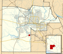
Location of Mobile in Maricopa County
|
|
| Country | United States |
| State | Arizona |
| County | Maricopa |
| Time zone | UTC-7 (Mountain (MST)) |
Sonoran Valley, also known as Mobile, is a small community in Arizona, United States. It is located in the southern part of Goodyear, within Maricopa County. Sonoran Valley is about 35 miles southwest of Phoenix, Arizona.
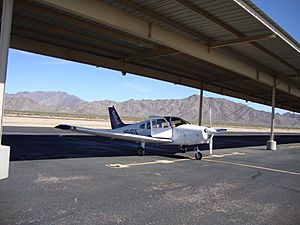
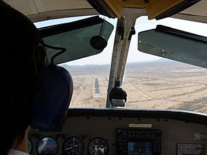
This area has a very small population, with fewer than 100 people living there. Sonoran Valley is also home to some landfills. A private airport, run by Lufthansa, is located north of Sonoran Valley. This airport is used for pilot training by students from Lufthansa Flight Training, All Nippon Airways, and KLM. The airport's special code is 1AZ0. It also has a system called ILS on runway 9, which helps pilots land planes safely.
Contents
History of Sonoran Valley
Early Days of Mobile
The community of Mobile started in the 1930s. It was a place where African-Americans could live. One important person from Mobile was Rebecca Dallis. She was an African-American woman who taught in Casa Grande around 1939.
Some stories say that early residents came from Mobile, Alabama. However, researchers found that railroad companies called the area "Mobile" much earlier. They used the name almost ten years before the first permanent settler arrived in the 1920s.
Life in the 1930s and 1950s
In the 1930s, two old railroad cars were used as schoolhouses. One was for black students and one for white students. About 100 homesteaders lived in the area at that time.
By the 1950s, the town grew to almost 400 people. But there were not enough jobs. There was also no running water or schools past 8th grade. Because of these problems, most of the original families moved away.
Sonoran Valley Joins Goodyear
In 2007, Sonoran Valley became part of the city of Goodyear. This happened as part of a large expansion. Goodyear grew by about 67 square miles (174 km2). This was part of a plan with a company called Montage Holdings. They wanted to build a new planned community in the area.
This new community was named Amaranth. The idea was for it to be a self-sustaining town. It would have a large shopping mall and places for people to work. Eventually, over 50,000 people were expected to live there.
Challenges and Delays
However, the Amaranth project was put on hold until at least 2010. This was due to a slowdown in the economy. The company also could not meet its financial promises to Goodyear. Because of these delays, Goodyear had to reduce emergency services to the area.
Where is Sonoran Valley Located?
Sonoran Valley is located at specific geographical coordinates. These are 33° 3' 19" North and 112° 16' 16" West. The private airstrip is a bit north of that. Its coordinates are 33° 6'43.27" North and 112°16'8.66" West.
How to Get to Sonoran Valley
You can reach Sonoran Valley by car. It is accessible from State Route 238.
 | Janet Taylor Pickett |
 | Synthia Saint James |
 | Howardena Pindell |
 | Faith Ringgold |


