Moccasin Mountains facts for kids
Quick facts for kids Moccasin Mountains |
|
|---|---|
| Highest point | |
| Peak | Lone Butte (Moccasin Mountains) |
| Elevation | 6,191 ft (1,887 m) |
| Dimensions | |
| Length | 11 mi (18 km) |
| Width | 8 mi (13 km) |
| Geography | |
| Country | United States |
| Communities | Kaibab, AZ and Moccasin, AZ |
| Range coordinates | 36°54′34″N 112°45′32″W / 36.90944°N 112.75889°W |
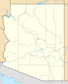
The Moccasin Mountains are a mountain range found right on the border between Arizona and Utah. They stretch about 11 miles (18 km) long. Most of these mountains are in Mohave County, Arizona, with a smaller part reaching into Kane County, Utah.
At lower parts of the mountains, you can see the Vermilion Cliffs. These cliffs form the borders on the northeast, east, south, and southwest sides. A large part of the mountains is also within the Kaibab Indian Reservation.
Two small towns, Moccasin and Kaibab, are located near the mountains. They are surrounded by the beautiful Vermilion Cliffs. Just 2 miles (3.2 km) south of Kaibab is Pipe Spring National Monument, a historic site. In Utah, the mountains are close to Coral Pink Sand Dunes State Park, known for its unique pink sand.
Contents
Exploring the Moccasin Mountains
The Moccasin Mountains are mostly shaped like a circle. They are about 11 miles (18 km) long from north to south. The southeastern part of the mountains has a canyon with a stream called Twomile Wash. This stream flows southeast and starts almost in the middle of the mountain range.
The towns of Moccasin and Kaibab are located in this southeastern area. There are also several natural springs in and around the mountains. Point Spring is just northeast of the towns.
Natural Springs and Water Sources
Two other important springs are found within the range. Meeks Spring is in the southwest, where Potter Canyon begins. This canyon flows towards the southwest and then south. In the central northeast part of the mountains, you'll find Willow Spring.
Another spring, Red Cliff Spring, is just east of the mountains. It is located at the base of the Vermilion Cliffs. This spring is also near the southern end of the Moquith Mountains.
Mountain High Points
You won't find any huge peaks right in the center of the Moccasin Mountains. However, there are some high points. In Arizona, about 1 mile (1.6 km) southwest of the Vermilion Cliffs, is Lone Butte. This peak stands tall at 6,191 feet (1,887 meters).
Near Lone Butte is the town of Cane Beds, Arizona, which is at an elevation of 5,099 feet (1,554 meters). This means Lone Butte rises about 1,090 feet (332 meters) above Cane Beds. In Utah, a high point called Dixie Knoll is located at the northern foothills, close to Sand Dunes Road. It reaches 5,859 feet (1,786 meters) high.
How to Visit the Moccasin Mountains
You can reach the Moccasin Mountains from different directions. Arizona State Route 389 runs along the southwest, south, and southeast edges of the mountains. This road follows the Vermilion Cliffs.
The towns of Kaibab and Moccasin, Arizona, are connected by a 4-mile (6.4 km) road that goes into the southern part of the mountains. You can get to Arizona State Route 389 from Fredonia to the east, which is near Kanab, Utah. From the west, you can access it from Hildale and Colorado City. Cane Beds is also nearby, to the east of these communities.
If you're in Utah, the northern and northeastern parts of the mountains can be reached using Sand Dunes Road. This road also leads to the Coral Pink Sand Dunes State Park. Sand Dunes Road turns south off U.S. Route 89, southeast of Mount Carmel Junction. The Moccasin Mountains are about 15 miles (24 km) from there.
 | William M. Jackson |
 | Juan E. Gilbert |
 | Neil deGrasse Tyson |


